
Trip up Pool Wash to our Northeast Corner
Going northward up Pool Wash, one encounters a sequence very parallel to the one outlined for Hot Springs Wash and Canyon. For about three miles up the wash from the main road, you ride on Quaternary alluvium, which (well below the Pool Wash windmill) becomes bounded by the Quiburis Formation ["Tq" on Map 1], low pale-reddish hills on each side. In Map1 below (see Goodlin & Mark, in Credits & Bibliography), two wash tributaries divide just above the windmill. (In this map, the road pathway is marked as blue dashes -- the road remains in the wash only as far as the yellow alluvium, then it climbs up the ridge.) You cross the Teran Wash Fault running NW to SE some distance above the windmill, but it is buried beneath Quiburis [Tq] overburdens here and not visible. The side-wash running from the Big Tank to the east has an outcrop of Galiuro Volcanics Formation ["Tg"] a short distance both below and above the tank. For background on this formation, see Geology Walk (2) Metamorphic Core Complexes & Detachment Faults.
Map 1

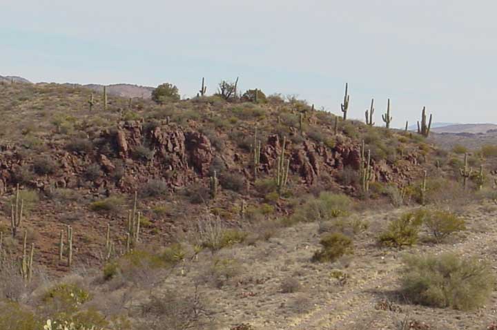
This Galiuro Volcanics outcrop downstream from the Big Tank appears here below (Click on the image for a close-up view of the rock),

while that flanking the wash upstream from the Tank appears from the vantage point of the Ridge Road below: (Click on the image to enlarge it.)

No San Manuel Formation appears in Pool Wash, though it is probably buried out of view, and it does appear exposed some distance to the southeast of the Pool Wash windmill, in Lower Sierra Blanca Canyon Wash.
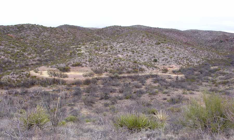
Above the Pool Wash windmill, where the road leaves the main wash and climbs the ridge toward the northeast, you begin to ride atop the Quiburis Formation [Tq]. Up along the Ridge Road, a view of the Diversion Tank ["D.T."] appears down in Pool Wash (on Map 2, below). In the image below you look toward the north to northwest, with the Main Tank located at left near mid-photo, while a Secondary Tank lies diametrically opposite it, linked visually by the Main Tank's diversion channel. This Secondary Tank lies at the base of a whitish deposit, while the Main Tank is reddish. The reddish color reflects Quiburis Formation, the Whitish is Galiuro Volcanics. (Click on the image to enlarge it.)
This whitish Galiuro Volcanics facies, which runs up the hill behind the Secondary Tank, appears in much stronger color contrast (if much poorer detail) in this camcorder image (taken from the Ridge Road but at considerably longer range to the northeast) from 1998:

This particular Galiuro Volcanics facies appears to consist of a whitish ashfall. On Map 2, below (with the Main Diversion Tank a small blue circle to the north of the Ridge Road), this outcrop appears in the "Tg" pink crescent with the icon "20" on it:
Map 2 (click on the image to enlarge it)

As the road continues upland (still running on Quiburis Formation) you can see another outcrop of Galiuro Volcanics, "Saguaro-Juniper Hill", below, lying directly to the north of the road and marked with a "24" on Map 2. (Click on the image to enlarge it.)
The Galiuro Volcanics facies are diverse in this area. Looking eastward, Sierra Blanca (with its southwest-running ridges -- see that link for more images) is also Galiuro Volcanics, here intrusive into the much older Willow Canyon Formation ["Kb" on Maps 2 & 3]. (Click on the image to enlarge it.)

Where the Ridge Road runs parallel to the lie of Sierra Blanca, and one sees a higher, paralleling ridge that seems to mark an almost horizontal flank of Sierra Blanca to the southeast, that ridge is actually separate from Sierra Blanca and is part of the Quiburis Formation (the beige strip running SW-NE on Map 2 above). The Ridge Road leaves the Quiburis Formation as it passes Saguaro-Juniper Hill and drops down toward the Old Hunters Camp, where it runs upon the distinctly reddish Willow Canyon Formation [Kb, marked in green on map 3, below].
Map 3 (click on the image to enlarge it)

In the image below, the hill in the distance is Galiuro Volcanics; nearby, near the old Hunters Camp ["H.C." on Map 3 (Click on the image to enlarge it.) the very strong tilt of these sedimentary facies becomes obvious.

For background information on this formation, see Geology Walk: (5) Older Patterns.
In the small canyon just below Hunters Camp you can see some very nice examples of the Willow Canyon, as shown below:

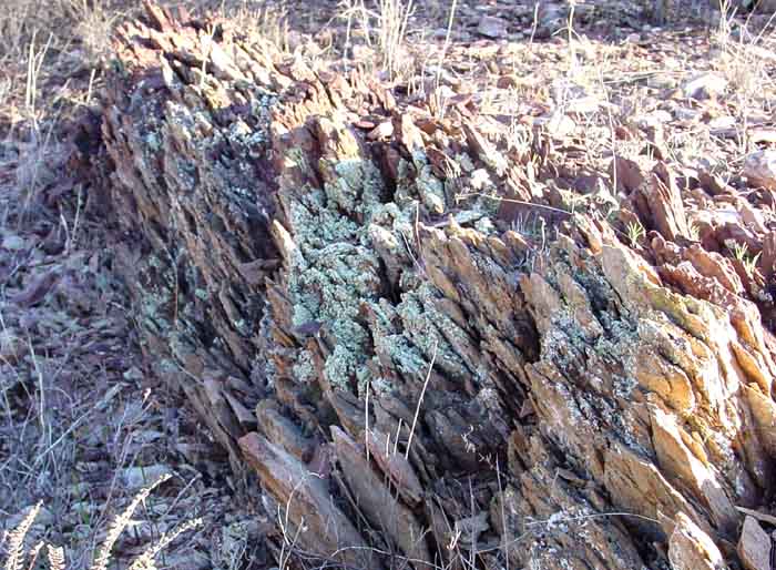
Then, if you walk across the Notch Wash just north of Hunters Camp, and ascend the low ridge heading toward the Notch (see this link for further map and image detail), you traverse some very interesting outcrops of the Willow Canyon Formation's characteristic conglomerates, mudstones, etc., all tilted at sharp angles to the horizontal toward the northeast. (On Map 3, this ridge is just northeast of the Hunters Camp. At some places the tilting is almost vertical. These are very good places to get some idea of the diversity of this 120 MY-old Formation -- for example, below, a strongly layered mudstone (click on the image for a close-up view):
A very distinctive kind of Willow Canyon Conglomerate is also exposed on this ridge (and may also be found as wash cobbles in various washes on our land), for example, below: (Click on the image to enlarge it.)

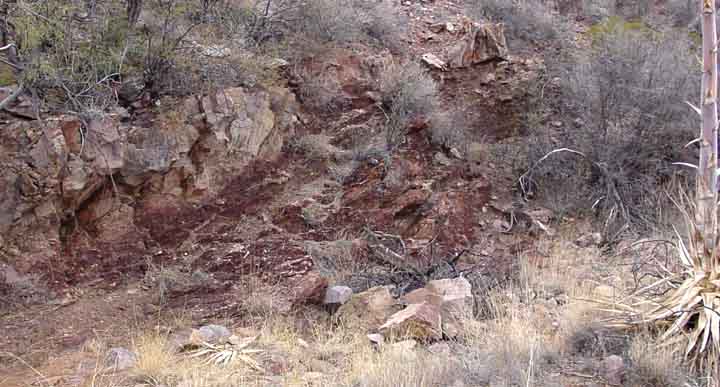
If you continue on the road past Hunters Camp toward the Trail Tank ["T.T."], you first cross the Notch Wash, rise up and cross briefly over the same ridge of Willow Canyon formation just illustrated, and then drop into the Trail Tank Wash. On the left bank of the wash, below left, Willow Canyon Formation tilts toward the northeast in a north-facing wall; below right, Shortly upstream and rounding a bend to the left, you see exposed to the left what appears to be a southwest extension of the Hot Springs Canyon Thrust Fault, which runs roughly along a NW-SE line at this point, and marks the end of Willow Canyon Formation (above) and the beginning of the Cascabel Formation (below) which lies to the north and northeast: (Click on each image to enlarge it)
 ...
...
Map 3 shows the Pool Wash Road [in blue] crossing the fault a short distance west of the Notch. The north flanks of Sierra Blanca are visible in pink at the bottom. The Trail Tank area (shown as a tiny blue circle Map 3 above) is located on the Cascabel Formation, as are both main washes draining the two sides of the Notch Ridge.
Above the Trail Tank In Trail Tank Wash, the Cascabel Formation shows some almost vertically fractured strata
(these north-facing outcrops are heavily covered with lichens):

The above photograph shows Cascabel Conglomerate at a distance of some 20 feet. The large boulder at mid-right (a white cap lies on the ledge to the left beside it for size comparison) is the most obvious piece of river clast visible at this distance. It has eroded out of the formation matrix far enough that it is now partially loose, and it has shed lichen buildup because it is quite smooth.)
Cascabel Conglomerate Boulder (eroded until loose in its matrix)

In this closeup, you can see both a lot of smaller clasts -- river cobbles embedded in the conglomerate matrix -- and the vertical line of cleavage which shows that the boulder remained embedded in the matrix when this particular vertical fracture occurred (thousands of years ago, probably). The river in which this boulder was rolled to smoothness ran here more than 65 MYa, so the original formation from which this river boulder itself was derived must be much older than that.
We seem to find many river-worn boulders in the Cascabel Formation which show their derivation from more ancient conglomerate sediments. For example, a hike along one ridge in the Northeast Corner of our lands revealed this remarkable conglomerate clast, which looks somewhat similar to some of our much older Willow Canyon conglomerates: (Click on the image to enlarge it.)

Clearly, this river-worn boulder has lain exposed at the top of this ridge for a long time, probably thousands of years, as it was gradually split apart into three main pieces by the persistent actions of water and temperature.
The contrast between Willow Canyon and Cascabel Formation is quite interesting when viewed from above, from the flanks of Sierra Blanca. The Willow Canyon appears to be considerably more barren of vegetation than is the Cascabel:

The boundary between the Willow Canyon Formation (on the left) and the Cascabel Formation (on the right) runs on a diagonal low ridge from upper left to lower right, on the far side of Trail Tank Wash (looking north). Note how the right-hand side is noticeably greener than the left-hand side. This contrast is not an illusion. Both formations are roughly south-facing slopes.
For more detailed illustrations of Cascabel Formation outcrops nearby, see Cascabel Formation in Sierra Blanca Canyon Wash.
The Notch Ridge is a rhyolite dike (intrusive formation), definitely associated with Galiuro Volcanics, but -- while the appearance of its rocks is very similar -- it is not clear whether it intruded at exactly the same time as the Sierra Blanca Formation. In Map 3, the Notch Ridge appears as the dotted black line running from SW to NE, bisecting the "Notch" label. (For more map and photographic details, see Notch Ridge & Basin.] Here, below, is a view of one short portion of it from its northern edge, looking southeastward: (Click on the image to enlarge it.)

Here is a closeup view of it, looking down its length in cross-section from near the Notch (looking toward the Northeast). You can see that the colors of its rocks are quite similar to those of Sierra Blanca:

Of course, the most compelling landscape view from our Northeast Corner is beyond our lands, toward the north and northeast -- the panorama of the Galiuro Mountains, shown here in closeup below. The hills in the low foreground lie on Saguaro Juniper lands; beyond are (1) the West Range of the Galiuros, in the middle distance, and (2) the much higher East Range further up in the background. Both display layers of Galiuro Volcanics deposits, but they are separated by a fault and (as you can see) are tilted in rather different directions. (Click on this link: Galiuro Mountains -- for more images, details, and maps of these mountains.)

For a summary placing the Pool Wash processes in their wider historical context, see Meader: Geological History of our Area.
Return to Geology Home Page