Lower Sierra Blanca Canyon Wash
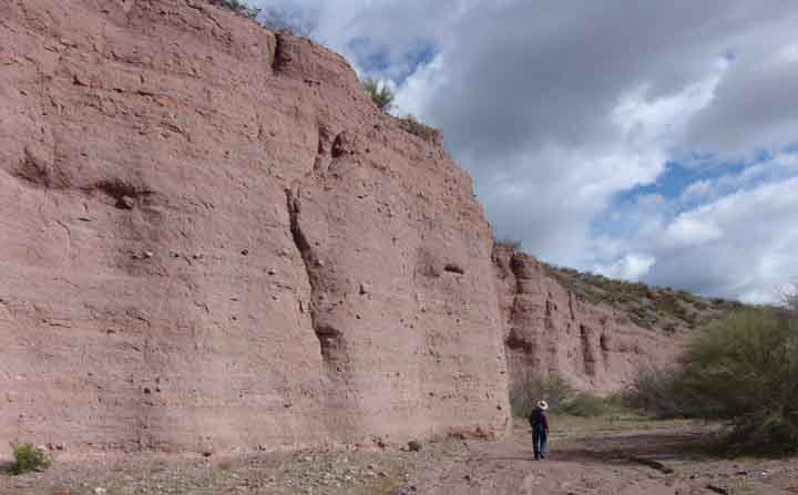
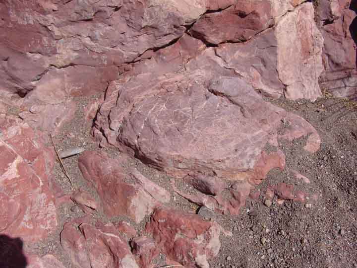
The downstream portion of this wash flows through tall, dark-thistle colored cliffs of Quiburis Formation, comprising nearly horizontal strata as shown in the image above. These beds are alluvial deposits of 7.5-5.5 Million years ago. As you walk upstream, outcrops of San Manuel Formation granodiorite-clast-laden gravels appear, as shown below. (These clasts, with their greenish cast, derive from the 1.65 Billion-year-old granodiorite Formation of the Johnny Lyon Hills to the south of our area.) (Click on the image for a close-up view of the clasts):
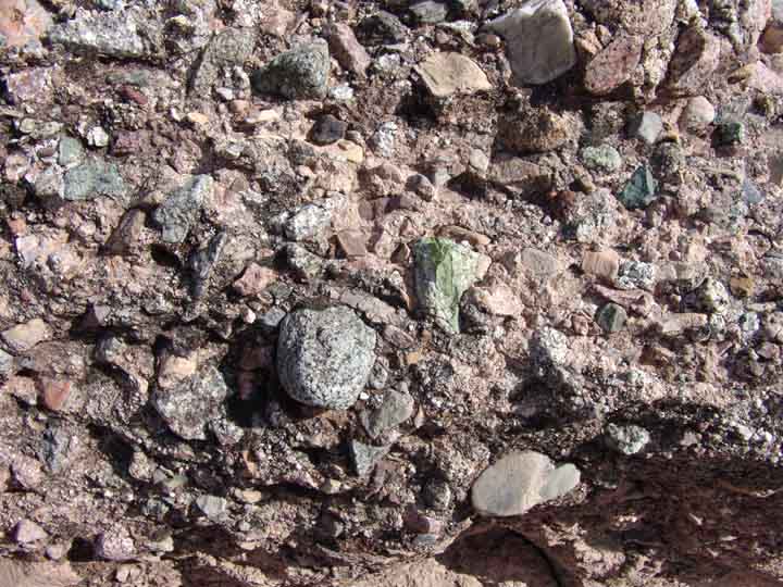
Unlike the Quiburis Formation, these beds are tilted (due to the Basin-Range faulting process which began long after they were deposited as alluvial gravels some 23-18 Million years ago).
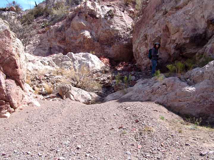
The San Manuel Formation continues for a considerable distance upstream. Below, small caves have been hollowed out where the wash has cut into the wall. (Click on the image for a close-up view):

The Geology Maps below are adapted from Goodlin and Mark (see Credits & Bibliography). At left, the entry into the Canyon is marked at lower left as a pathway through Quaternary Alluvium [Qal], colored yellow. The flanking formation, rendered in bisque color, is Quiburis Formation [Tq] (illustrated in our banner image at the top of the page). Further upstream is the San Manuel Formation [Tsm], colored salmon. On the map at right, the Teran Wash Fault is marked by a dotted black line at the top, curving downward as a solid line then becoming dotted again at lower right. The Willow Canyon Formation [Kb] appears at this juncture, marked in a dark sea green color, and nearby at lower right is Mineta Formation [Tm], colored sandy brown. The map below right shows the disposition of the Wash more clearly with blue dashes. At and near this conjunction with the Teran Wash Fault, there is some very complex geology near the point where the wash forms an island, and a side-wash also runs in from the north along the line of the fault. (click on the right-hand image if you want an enlargement.)
 ...
...
In particular, note the marking of a fault perpendicular to and connecting with the Teran Wash Fault at this point. Earlier geological research on the Teran Wash Fault, by Jeffrey Grover (1982, see Credits & Bibliography), labeled a triangular area along this side-wash as a complex of sedimentary and igneous rocks, one part of which at least was dated to 64.4 My. (Click here for a view of Grover's map, notably the area he marks "Ksv".) Goodlin and Mark do not confirm this complex in their map. On these pages we make no attempt to consider the differences between the two sources, but will simply provide a few images suggesting the complexity in this area (which includes a tall Island standing in the middle of the wash, clearly shown on the map above right, a location also marked with the number "59")
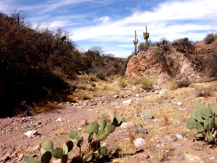
First: when you arrive at this part of the Wash coming from downstream, Sierra Blanca comes into view toward the north, as shown below: (click on the image for a closer view of the wash deposits)

This view above was taken looking up the side-wash that comes into the main wash from the north at the downstream end of the Island shown on the map. The image includes some of the complex geology suggested above. Below, see three images of this complex geology, shown from different points of view (click on each image to enlarge it):
 .....
..... ...
...
The two images at left and center were taken looking up the side-wash that drops down from the north at the lower part of the island. The image at right looks across the Wash from the southeast side of the Island in the center of the Wash, toward the southeast. (This latter view shows at bottom the left-arm of the main wash at the Island, which is a flat terrace -- see more below.) The formations here are Willow Canyon Formation, perhaps connecting with Mineta formation in the image at right. (For more details about the Mineta complex, see the Trip up Teran Wash.) Most of the Island itself is Willow Canyon, but the downstream end anyway is San Manuel Formation. (See more below.)
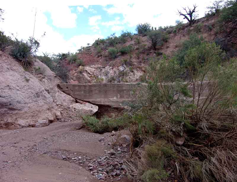
Viewing the right-hand arm of the wash from downstream, below left, an interesting feature appears. In the foreground, flanking the wash on both sides, is the San Manuel Formation. In the background, the reddish and whitish rocks jumbled together are Willow Canyon Formation in the Island. In dead center, running horizontally across the wash, lies a concrete dam, constructed by area ranchers perhaps half a century ago. (Click on each image to enlarge it.) As you can see from the layering of the concrete visible in the right-hand image, a quite substantial amount of labor and material was invested in this structure, which must have nevertheless failed (at least filled up with rock debris) after a decade or two. In any case today it remains as an icon of human folly (and at least some of our own earthen tanks may be viewed in a similar light, though none reflect the size of investment evident here, in the lower part of a large wash where occasional rock-&-water flows must be very heavy indeed).
 ..
..
Below, taken at a location near the previous photos, at the junction of the right arm of the main wash and the western side-wash but looking downstream, the lower tip of the Island (all of it San Manuel Formation here) occupies the upper portion of the image, trailing down to the point where it becomes a low embankment with a small cave, past which the wash goes out of sight.

Below are two views of the Island from further upstream, at left as seen from the terrace above the Canyon on the southeastern side of the wash (land at near-left foreground). In this image the Island can be seen rising to a massive height, sort of a butte, occupying the whole upper-central part of the photograph in the distance, dropping down at the downstream end (far left) and extending out of view upstream to the right. The left-hand arm of the Wash, visible at the middle and right of the photo below the edge of the top terrace on which the viewer stands, has (for some time now) become a flat, dry floodplain lower terrace with a scattering of mesquite trees distributed over it. At right, the Western side-branch (right-hand arm) of the stream is the active wash, running away from the viewer in this image, with the Island looming up on the left side. In this image the whitish rocks are Willow Canyon Formation. (Click on each image to enlarge it.)
 ...
...
Below, a view standing on the left arm of the Wash that skirts the Island -- this wash now a very flat terrace with only local drainage -- looking downstream. Here the left side of the Island displays an outcrop of whitish Willow Canyon Formation rocks at its base but more reddish rocks toward its top.


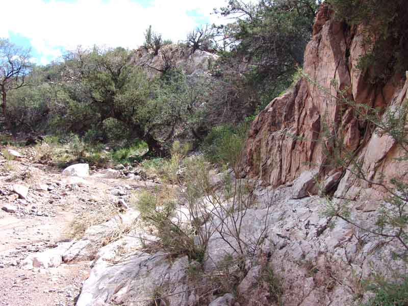
Moving upstream from the Island, the wash is almost entirely bounded by Willow Canyon Formation rocks. These present a variety of facies -- "an assemblage of rock features reflecting a distinctive environment in which rock was formed". For example, at left is a view of the south wall of the Canyon a short distance upstream from the island. (Click on the image to enlarge it.)
At right, further upstream we see two distinct facies in juxtaposition, the lower one whitish in color and the upper one closer to dark salmon. Both are sedimentary rocks. (Click on the image to enlarge it.)
The whitish rocks, as seen below, are a small-clast conglomerate. (This was also true of the whitish rocks at the base of the left side of the Island, shown above.) (Click on this image to enlarge it.)

Below left, looking upstream, a mix of tan and white rocks appears; further upstream, below right, you can see another mix along the east (left-bank) side of the canyon. (click on each image to enlarge it):
 ..
..
Below left, a side-wash enters the main canyon left bank at grade. This point is marked as 4651 on the topo map below right. (click on each image to enlarge it)
 ...
...
Some distance up the "4651 side-wash", a juxtaposition of the two kinds of Willow Canyon facies looks like this:

Returning to the main Lower Sierra Blanca Canyon Wash, further upstream, the Canyon opens out, and a red facies can be seen below left crossing it. Below right, you can see that beyond this red outcrop another white facies is evident: (click on each image to enlarge it):
 ...
...
We then arrive at the visually most striking point of this Willow Canyon, a sharp cut that bends upstream to the west, and marks boundaries between at least two different facies: (click on each image to enlarge it):
 ...
...
This is the location marked as 4664 on the topo map shown above. From the upstream side, below, the boundary between red and white facies becomes quite striking. The image at right shows a close-up of the boundary: (click on each image to enlarge it):
 ...
...
Below is a ruder image of this boundary (discordance) taken from another angle at an earlier time. This is also the location at which the Mark and Goodlin Geology Maps shown near the top of this page indicate a Fault (marked on the Geology Maps, and also on the Topo Map above, by a toothed black line). This may be a detached portion of the Hot Springs Canyon Thrust Fault system. (See that link for more details on the main part of this Fault as it appears in Hot Springs Canyon further upstream.)

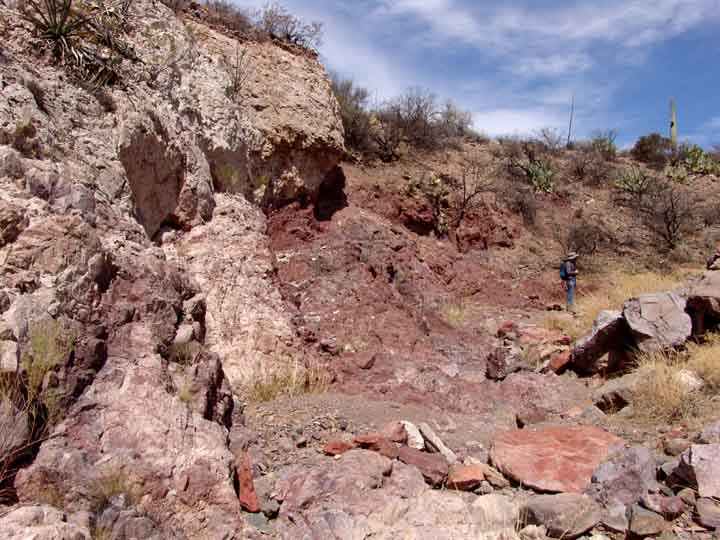
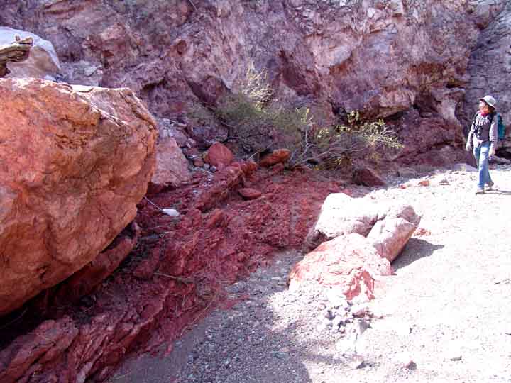
A short distance further upstream, a very bright red facies peeps out beneath a more complex set of rocks above it. This looks different in different lighting, but this is a quite distinct body from the previous set. Notice in the middle photo its firebrick-red color and how it seems to flow beneath the larger facies. This is probably part of the detached Fault shown on the Geology Map -- an internal thrusting of the Willow Canyon Formation. (click on each image to enlarge it):
 ...
... ...
...
A short distance further upstream, the canyon opens out, we encounter more reddish outcrops (below left), and also -- more prominent as the wash turns in a more northerly direction -- a distinctive facies appears along the floor of the wash (below right): an extensive rosy-brown bedrock: (click on each image to enlarge it):
 ...
...
this facies looks identical to the Willow Canyon Formation facies we have seen some three miles distant, in Upper Hot Springs Canyon at the Zig-zag Bend. Below, close views of the bedrock, showing yellow streaking like those evident in the Zig-zag Bend facies: (click on each image to enlarge it):
 ...
...
For comparison, see the Hot Springs Canyon materials -- scroll about 2/3 down the page for comparable forms -- and below see two examples of tortured mudstone, also similar to the facies in Hot Springs Canyon (click on each image to enlarge it):
 ...
...
These are very fine-grained strata, indeed, and they are deformed in ways similar to the Willow Canyon Formation rocks in Hot Springs Canyon.
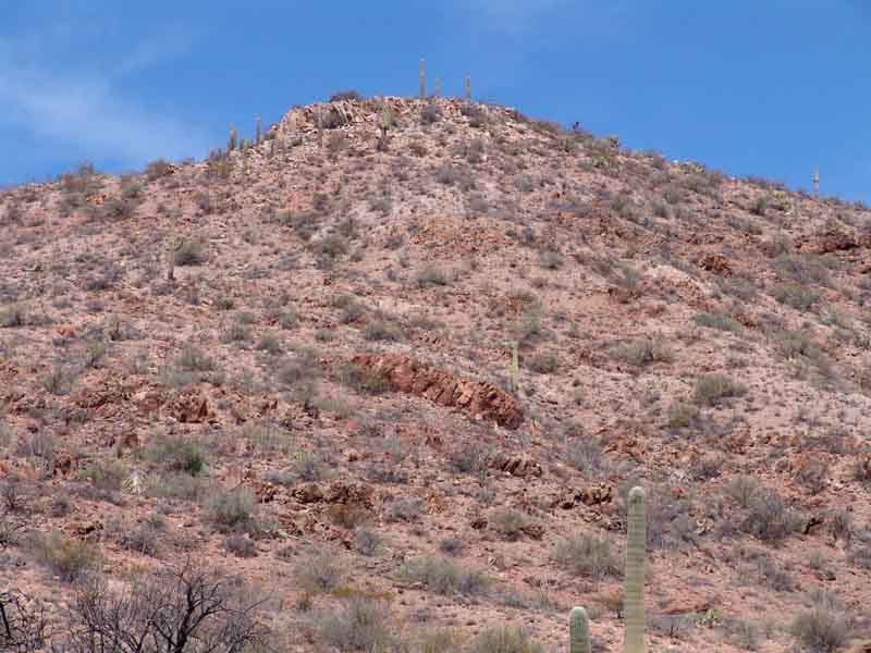
From approximately this location in the Sierra Blanca Canyon Wash, we look up toward Sierra Blanca ridge 4001 (see Topo map, above), below, seeing distinctly reddish, strongly northeast-tilted Willow Canyon rocks exposed on the hillsides in the lower two-thirds of the photo, while the lighter-colored, Galiuro Volcanics rocks of Sierra Blanca comprise the summit of our mountain. (Click on the image to enlarge it.)
............................................................
For a summary placing Sierra Blanca Canyon processes in their wider historical context, see Meader: Geological History of our Area.