
The Galiuro Mountains
The Galiuros Mountains form the visually most conspicuous of the Sky Island backdrops to our Saguaro Juniper lands, as illustrated in the accompanying photographs. Viewers take note: the main aim of this page is to provide a visual and map-oriented overview of the dimensions of this mountain complex. For more detailed discussion of the ecological significance of this Sky-Island for our area, see this associated link: Galiuros Ecology.
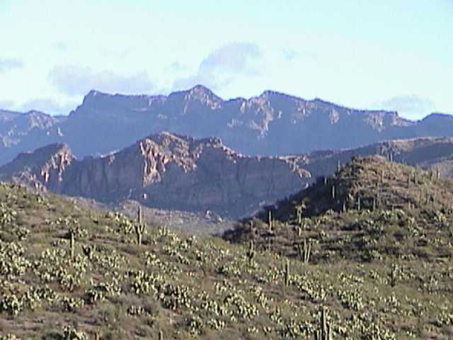
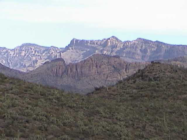
Most of our images show these mountains as we typically see them, from the west, with Bassett Peak the obviously highest one in these images. (To enlarge the images, click on them.)
 ....
.... ....
....
 .....
.....
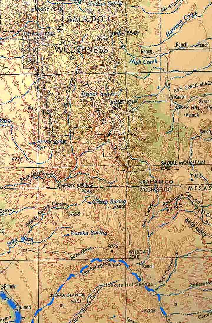
Speaking very roughly, these mountains form an approximation to an "H" figure when viewed from above, as they are bisected into two parallel ranges (a West and an East range), as can perhaps be sensed from a view of the map at left.
For a Google Earth image that places the Galiuros more clearly in their broader relationship with the San Pedro Valley, Click here.
If you use the enlargement of the map at left, you can see that the West Range runs from Kielberg Peak near the northwest corner of the map directly southward almost to the Graham/Cochise County line, then jogs east to Cherry Spring Peak, then again southeast, now broken up by the streams which cross it from the center of the "H" toward the west, including Redfield Canyon, Cherry Spring Canyon, and our own Hot Springs Canyon (highlighted here in blue). Although the Kielberg Peak reaches an elevation of 6880 feet, most of the West Range is considerably lower -- the West Range landmarks closest to us include the Wildcat Peak (4885') and the Red Peaks (5266') that lie to the southwest of Hooker's Hot Springs, and as the Range continues toward the south it forms an increasingly broken series from the Teran Escarpment to the Johnny Lyon Hills.
The East Range is overall much taller and more massive, running (on our map at above left) from Sunset Peak at more than 7,000' directly south through Bassett Peak (at 7,650' the highest peak in the Galiuros) through Pine Ridge and Bald Ridge northeast of Hookers Hot Springs. Bass Canyon, an important tributary to Hot Springs Canyon, runs down the eastern slope of this range.
Better than any map for giving a sense of the topography is this image below, copied from Google Earth. Here, viewing the mountains roughly from the south, the distinction between West and East Ranges is much more clearly marked (though the dark streak running diagonally down the trough is false-coloring and accentuates the division even further than it deserves).The flat table of Soza Mesa is clearly visible at far left, lying above Hot Springs Canyon. Bassett Peak stands out as the highest prominence along the East Range.

In this Google image, viewing the mountains from the north, Kielberg peak lies to the left of the white logo that references it, while Kielberg Canyon runs to the right (toward the west) below it.

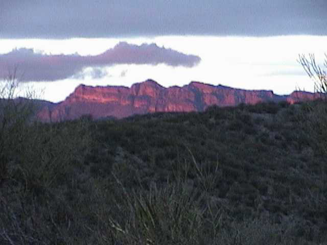
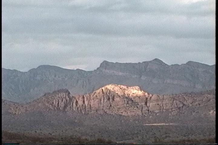
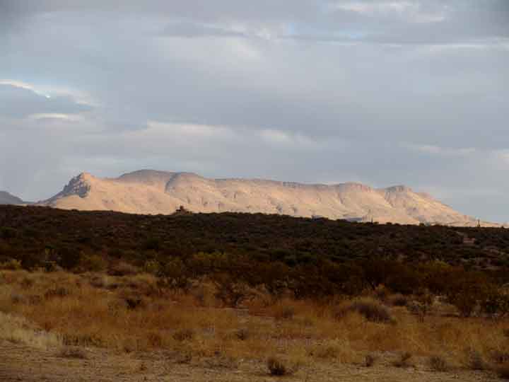
Below, viewed from the southwest, Bassett Peak in the far background, toward the right, is largely in shadow, while Kielberg Peak (toward the left) is obscured in clouds. The much lower run of the West Range at this location is sunlit, including Cherry Spring Peak, well left of center. Note the straight horizontal line of Soza Mesa at lower-middle left.

Below: a more panoramic view from the Ridge Road above Pool Wash, with Saguaro-Juniper Hill in the left mid-ground and the Saguaro juniper uplands lying behind it. Behind these hills lie the sunlit southern extensions of the West Range, while its most prominent peak, Kielberg, lies in shadow toward the far left. Bassett Peak is still sunlight at roughly mid-photo, March 2003.

Below: a similar view from April 2002, when all the mountain tops were obscured by clouds. Clouds spill downhill from Bassett toward the right.

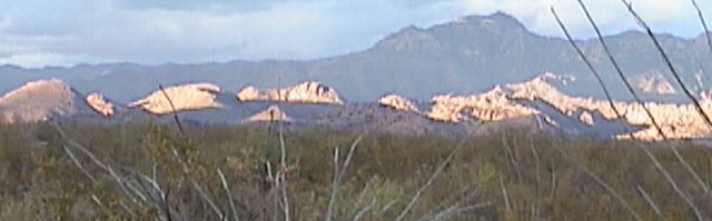
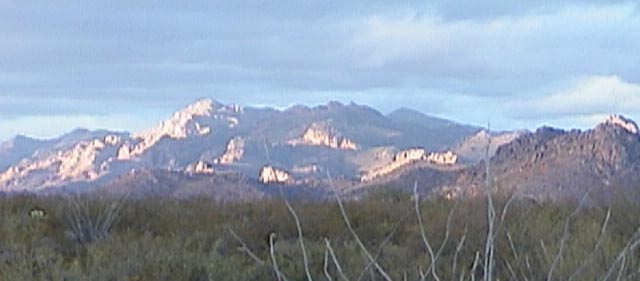
Below left: view from the eastern edge of Soza Mesa, looking north toward Kielberg Peak (at sunset); Below right: another view from Soza Mesa, looking north-northwest at sunset, toward Kielberg Peak.
 ........
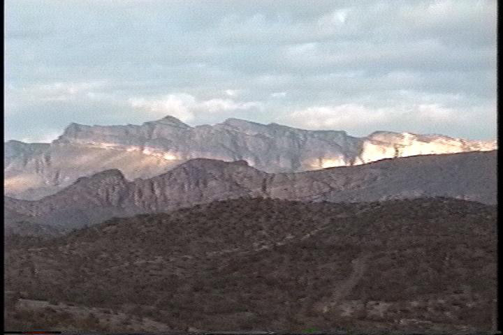
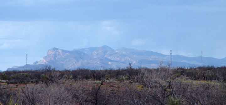
On July 7, 2006, we took this image during light rain from the headwaters of Pool Wash. Looking almost directly north, the view straddles Kielberg Peak on the horizon at left and Bassett Peak at the right:

Below, a view of Kielberg Peak taken from the northeast portion of Saguaro Juniper lands, with Soza Mesa again marking the horizontal baseline.

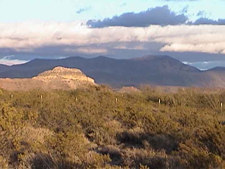
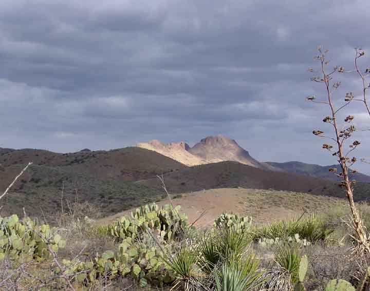
Below left, looking southwest from Soza Mesa at November sunset past Wildcat Peak, along the West Range of the Galiuros (brightly sun-lit, at left-center, middle distance); the Winchester Mountains appear in shadowed background. Below right, the Red Peaks (which include Bass Peak, at 5268' elevation) viewed from the northeast corner of Saguaro Juniper lands, looking toward the east-southeast. Click on each image to enlarge it.
 .....
.....
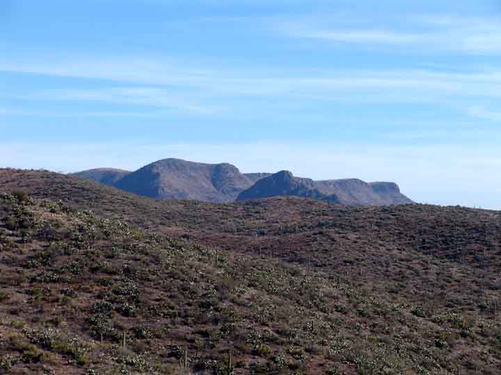
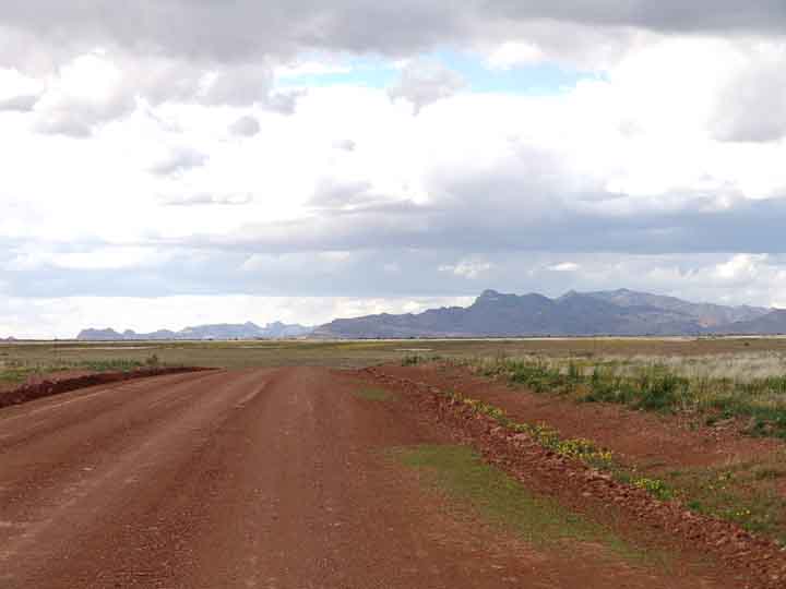
The relationship of the Red Peaks to the Teran-Kelsey Escarpment, which forms the southeastern backdrop to the Teran Basin, is shown below in this panoramic view taken from near milepost 8 far to the southwest. In this image, the Red Peaks stand at the center of the photograph, while the Teran Cliffs stretch out to the right. These are southern outliers of the West Range. The main body of the Galiuros is hazy at high far left, while The Narrows of the San Pedro River is marked by the green gap between the two rocky ridges at low left foreground. Sierra Blanca is just visible as a small, hazy cone well to the left of the Red Peaks.

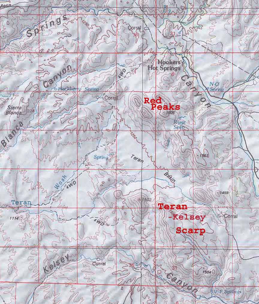 On the Map at left, the position of the two sets of outlier peaks is highlighted. Click on the map to enlarge it. Below, see two further views of the Teran-Kelsey Escarpment. The image at center is taken from north of Sierra Blanca, looking southeast, while the one on the right is from the road near lower Hot Springs Canyon, looking east. Click here on Red Peaks & Teran-Kelsey Escarpment for further details on these two sets of formations.
... ...
...
Speaking ecologically, the southeastern side of the East Range of the Galiuros is very important as a source of Hot Springs Canyon's permanent water, and their neighbors further to the southeast, the Winchester Mountains, are also very important to us, since the floodwaters of Hot Springs Canyon come largely from the western slopes of the Winchesters.
Here, below, are views of the Galiuros seen from the Tree Links Road than runs toward the Winchesters (left) and then from Allen Flats (right), where headwaters of Hot Springs Canyon (and also Tres Alamos Wash) run down from the Winchesters. The views are toward the north. The West Range of the Galiuros --much lower, lighter in color -- contrasts nicely with the East Range in the photo at right.
. ...
...
The left-hand view shows only the East Range of Galiuro mountains, with their highest peaks (a zoom view taken while rising up the terraces that descend to the San Pedro river); while the right-hand view shows also the much lower southern extension of hills running from the West Range line of the Galiuro Mountains.
Click on this link for views of the long eastern front of the Galiuros, taken from the top of Mt. Graham well to the east and looking across the Sulphur Spring Valley.