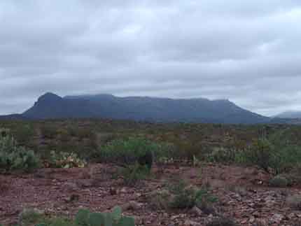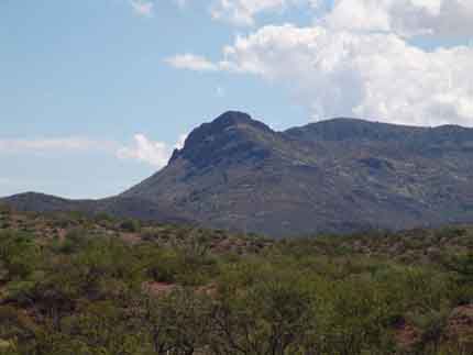
The Red Peaks and Teran-Kelsey Escarpment
In the image above, the Red Peaks stand at middle-left in the far distance, the Teran-Kelsey Escarpment at middle-left to middle-right in this photo taken in July 2006, with Quiburis-era terraces running horizontally across the entire photo in the mid-distance. This mountain complex is a southern extension of the Western Range of the Galiuro Mountains (q.v.), drained on the west side in this extension mainly by the Teran Wash and Kelsey Canyon Wash, as shown on the map below [North at the top].

The Red Peaks

Above, viewed from near our Red Tank looking toward the northeast, the Red Peaks display their volcanic origins. They are Galiuro Volcanics remnants dating from roughly 28-20 million years ago. The red hill in mid-distance left is a different formation.
Below, two views of the Red Peaks from the general latitude of Sierra Blanca, looking eastward; at left, taken from Hill 4232 in our NE corner in March 2003; at right, over a much greater distance, from Soza Mesa (with the Notch visible at mid-distance left) in August 2001. Click on each image to enlarge it.
 ..
..
The Teran-Kelsey Escarpment
 ..
..
Above, two views of the escarpment under differing light conditions. At left, a photo taken at sunset from the Lower Hot Springs Canyon terrace in January 2006; at right, from the same location in July 2006. (Click on each image to enlarge it.) Geologically, this escarpment is the strongly-tilted San Manuel Formation of sedimentary-and-ashfall rocks deposited during and after the Galiuro Volcanics phase (23-18 Mya) and then sharply tilted away from the Valley as Basin-Range block-faulting occurred (15-10 Mya). The sedimentary layering of this Formation (here, called the "Kelsey Canyon Facies") is hardly evident in these images, but here are two closer ones, below, illustrating both layers and tilt. At left, you can see the curving arch of the tilt along the left side of the main ridge, photographed in March 2003 from the Pool Wash ridge road. Note the northwestern outlier of the Escarpment, just right of dead center in the image. At right, both layers of strata and strong tilt are visible in this closer view of the outlier, photographed in September 2006 from south of the Red Tank. (Click on each image to enlarge it.)
 ..
..
Below, a view of the Teran-Kelsey escarpment from the south, captured at the end of October 2007 along the 3-links Road looking northward. The tilt angle of these Galiuro Volcanics beds show up most clearly along the lower part of the photo beyond the foreground (creosotebush-dominated) vegetation. Below the tilted strata and out of view, Kelsey Canyon runs from right to left as it descends toward Teran Wash.

Below, a distant sunset view of the Teran-Kelsey esccarpment taken on the banks of the San Pedro River from a number of miles further downstream, following late monsoon rains on September 1, 2008:
