Upper Hot Springs Canyon Photostations
Note: Locations and directions of our photographs differ somewhat since the stations were not set up at the time of our earliest films (some 1987; mostly 1993 and 1996). The seasons also differ. These comparisons thus lack control and hence are of very limited scientific value. Nonetheless, we believe that any photographic comparisons are better than none, and with time our control of both sites and seasonality will improve. These at least provide some documentation of changing vegetation since the last scouring flood of January 1993.
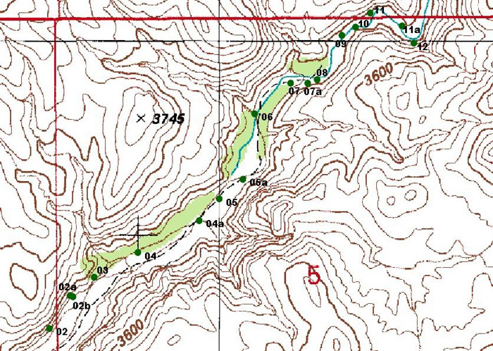
For an enlarged map image of station GPS locations from 02 to 12, click here.
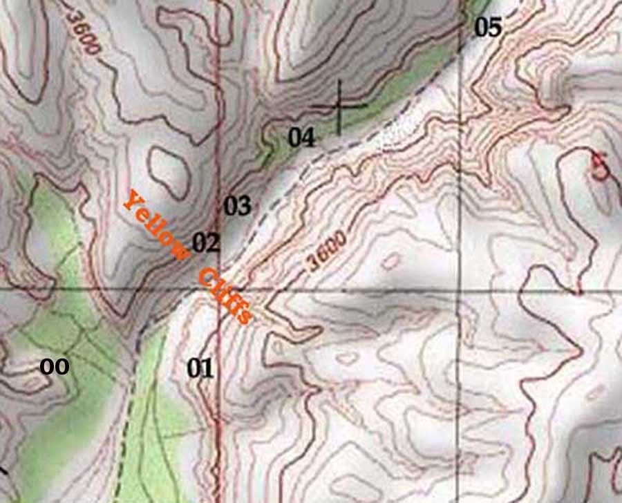
no. 00
USGS Station
no. 01
Buzzards Roost
no. 02
The Window
no. 03
The Purple Rock
no. 04
above the Window, where Galiuro Volcanics ridge drops to the wash
In the photo below (which was taken from the north above the Hot Springs Canyon looking southward [downstream]), you can see the numbers indicating 3 of the photostations presented further below -- numbers 05 through 07). Click on the image to enlarge it.)
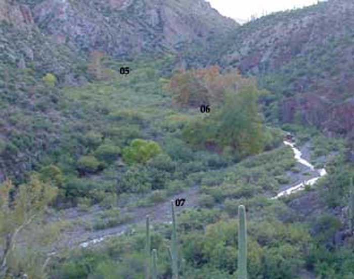
(see this map link for further numbers)
no. 05
The Gateway -- cottonwood and sycamores
no. 06
Coati terrace, Red Trail
no. 06A
Red Trail Overlook
no. 07
Below the Bend
no. 08
Below the Narrows, Terrace Views
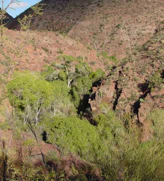
The Narrows is marked on the map below left (which also shows rough locations for photostations 07 through 12), and in the image below right the upper slopes of the Narrows cliffside can be seen running near the bottom of the photo, from lower left to bottom center. The basic form of the Zig-Zag bend also shows clearly in this photo: the Zig/Zag begins at the cliff-face at the center and ends higher up in the upper-right quadrant of the photo. Click on the map image to enlarge it.
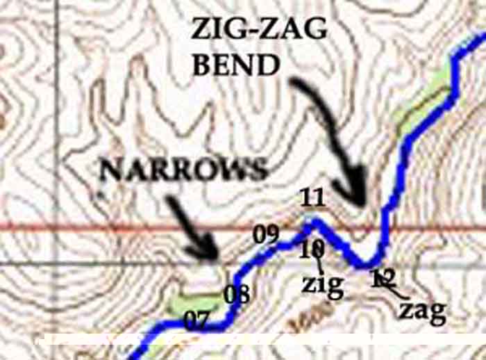
no. 09
Narrows to Zig Bend
no. 10
The Lower Zig
no. 11
The Upper Zig
no. 12
The Zag
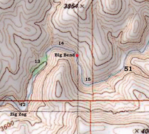
Note: Above the Zag -- above station no. 12 -- we have not yet established the photostations listed below with any precision, with the important exception of Area 51 -- the Station established by the USGS in 1965, which we have now definitely identified and re-photographed. However, we have not obtained GPS readings for any of them. For the intermediate areas numbered below, we present a number of photographs, mostly taken with a low-resolution camcorder, but which provide some candidates for future stationing.
The red star marking on the map above shows the rough location of the Bureau of Reclamation's projected Fish Barrier for Hot Springs Canyon.
no. 13
Rock Circle
no. 14a
Big Bend West
no. 14b
Big Bend Central
area 51
USGS 1965 Station