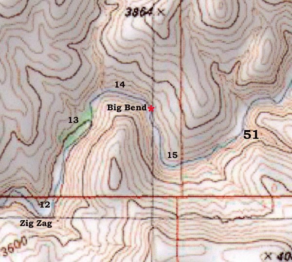
#51
USGS Set 4: Zimmerman's elusive "Site 51", located not in southern Nevada but in southeastern Arizona, above the Big Bend in Hot Springs Canyon! For map reference, click here.
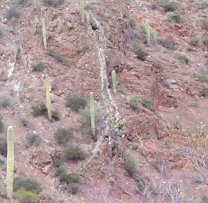
Zimmerman Photo of #51, 1965. Click on the image below for full enlargement.
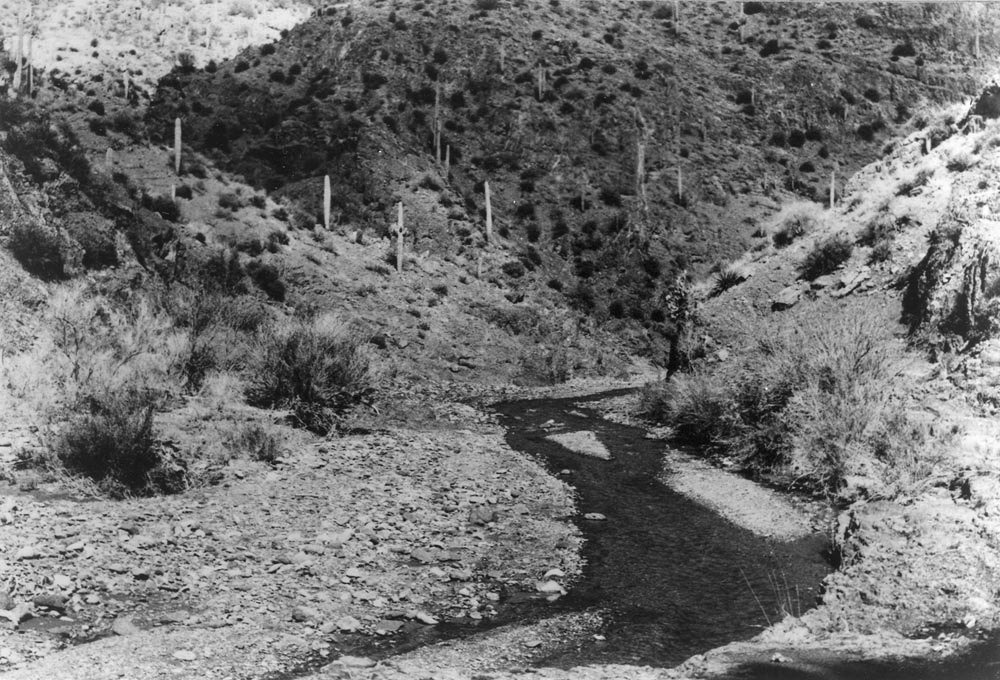
Most striking in this image is the absence of riparian vegetation. Zimmerman...
After 1965, this photostation was apparently lost to the USGS, since it was not included when the repeat photographic series were taken further downstream in 1984 and 2003. Beginning about 2000 Saguaro Juniper made a few desultory efforts to find it, but only in the Fall of 2007 did Daniel Baker and David Omick intensify the effort sufficiently that Omick found it in January 2008. Since the site was so overgrown that filming from the precise location was no longer feasible, David had to work with resident landforms, including a vertical streak in the rock in the center of the far hillside (photograph above) that made certain identification possible:
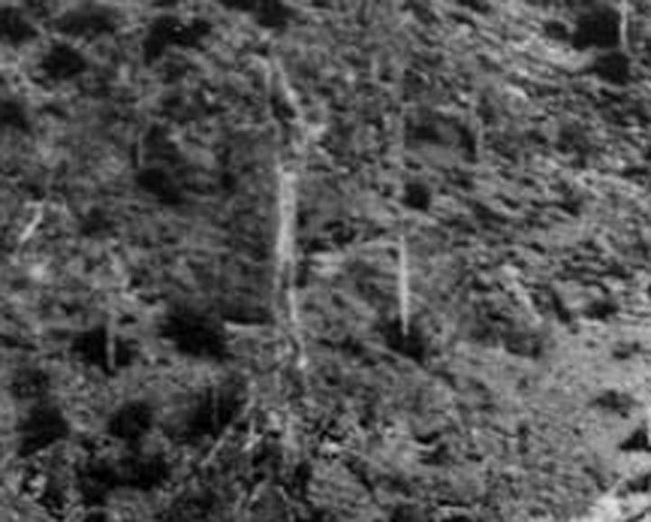
While the resolution of Zimmerman's 1965 photograph is not very good, one can see that the rock streak (image center above) forms an elongated rectangle in its middle, splaying out into double vertical streaks above and below.
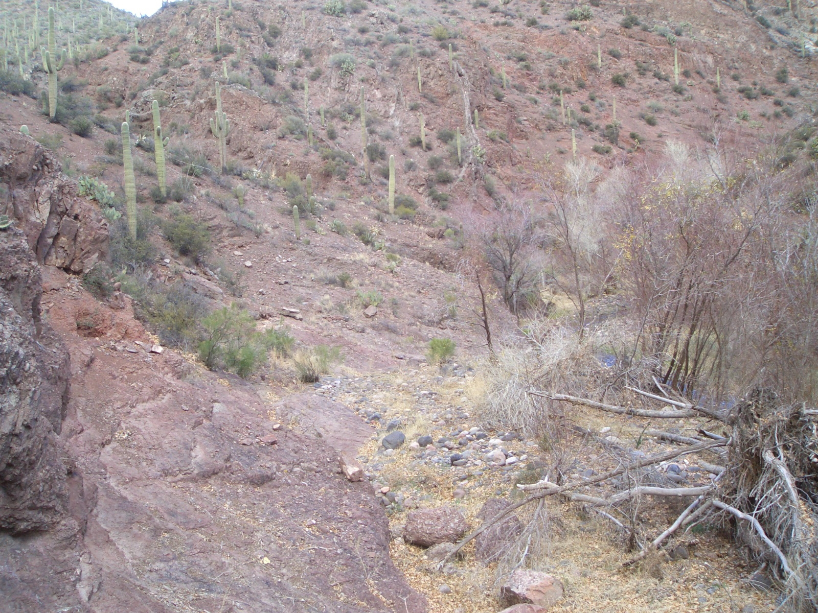
David's initial photograph in 2008, below, caught the same vertical streak, though he took this picture across the stream from the location of Zimmerman 51 because that area is completely tree-filled. This image views the streak from the right bank side rather than the now tree-obstructed left.
Click on the image below for full enlargement.
The vertical streak appears much more clearly in this image. though from a slightly different angle than Zimmerman's. In any case, the identification of this site as #51 is definite:
A striking feature of this entire Area 51 location is the density of trees in the 2008 photos. When David returned in February to document the location further, he climbed the hillside from further downstream to get a more comprehensive view, as shown below.
Click on the image below for full enlargement.
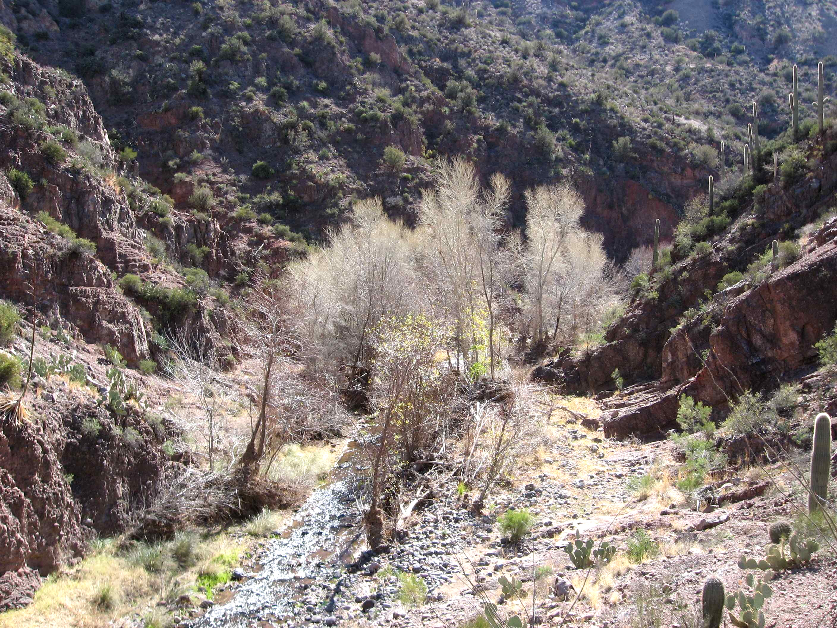
The original 1965 photo was taken from the left bank of the stream bed (right-hand side in the image) just below the center of the photo, perhaps close to the fallen tree trunk. David's original 2008 photo further above was taken from the rocky outcrop on the right bank of the stream, near photo center.
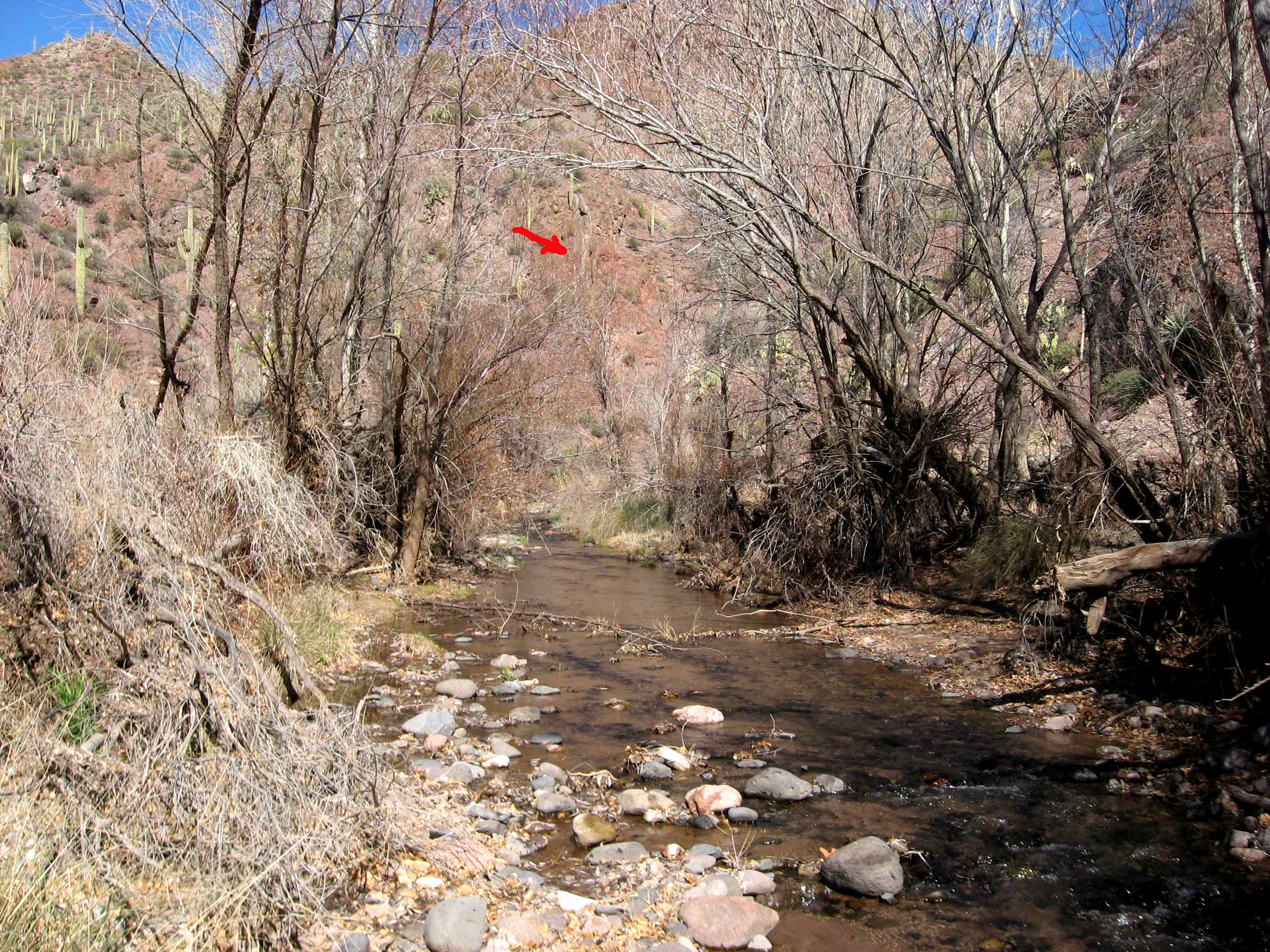
David reports that this image below is taken from a spot very close to that of Zimmerman's 51 (which was located across the stream to the right but now amid dense trees). The diagnostic white rock vein is at upper-center, indicated by the red arrow.
Click on the image below for full enlargement.
...................................................