Part two: Blanding to Capitol Reef
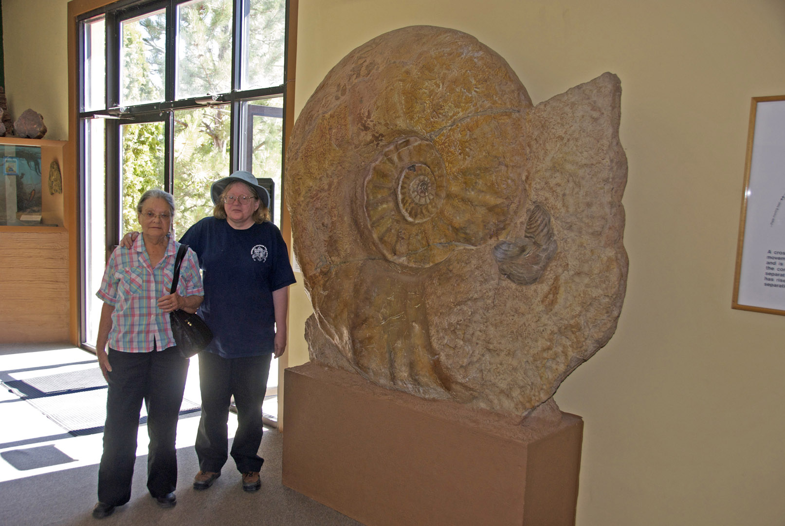
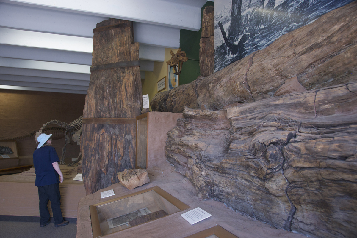
For convenience now, we will start our trip record at Blanding, Utah, a lovely town in the Blanding Basin which boasts two fine museums. Both deserve better publicity than they can afford to attain. First we went to the Dinosaur Museum (see that link), a beautiful place that includes an active research facility. Below left, Judy Warner and Helen stand beside the largest Ammonite fossil I have ever seen, near the entryway. Below right, the Museum's display of petrified wood from early dinosaur times. Click on each image to enlarge it.
 ..
..
I will not present many more images from this Museum here, though they allowed full freedom to photographers (the exhibits were highly informative and included current research interpretations), but I must comment on one aspect of the experience: they gave special recognition to Charles Knight, who drew the famous dinosaur images published in National Geographic during the 1930s which first aroused my interest in geology as a child and led me, as a jock-scholarship freshman at the University of Wyoming in 1949, to take the introductory course in Geology he taught there at the time. This was the most stunning educational experience I had ever had, from the most charismatic teacher I have ever seen. In the Museum presentations I learned that he had died in 1953, just 4 years after I took the course; I had no idea that he was drawing dinosaur images in the 1890s and was born in 1874; I went on a field trip with him that freshman year and he seemed young, though perhaps it was mainly his congeniality to me that seemed un-elderly at the time. His lectures were extremely dynamic and full of the unexpected, including on one occasion throwing an eraser at a sleeping student, and another recounting a memorable dream he had just had.
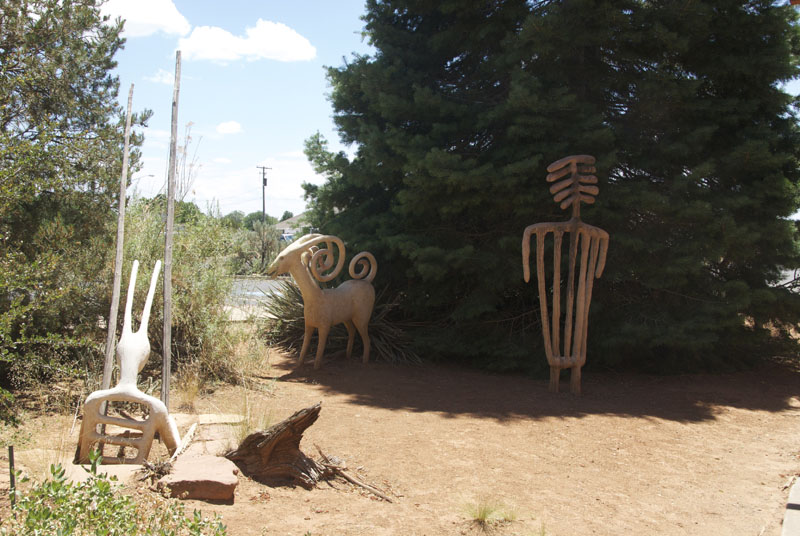
We then went to Blanding's second major prize, the Edge of the Cedars State Park Museum (see that link), where I didn't take my camera into the museum. I did photograph some sculptures outside, see below. Suffice it to say that the Museum and research facility provide an excellent survey of southwestern Archaeology, and they deserve better patronage and publicity than they appear to be getting.
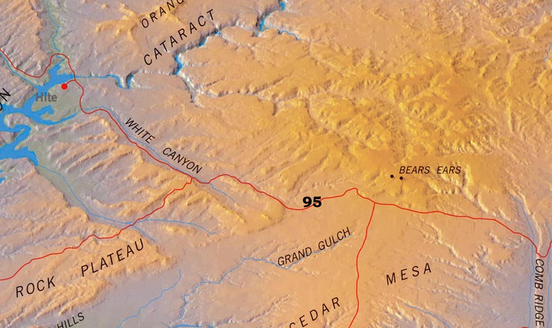
Blanding Basin, which derives its name from the city, is a fairly shallow trough with its boundary at Comb Ridge on the west and at the Red Rock Bench just south of the Arizona border on the south. (We don't deal with it here, though it has deep structural connection with the Paradox Basin, an invisible but economically very important ancient basin that runs north beyond Moab to the Green River area.) In the Blanding Basin we drove west on State Highway 95, heading toward Capitol Reef:
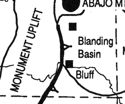
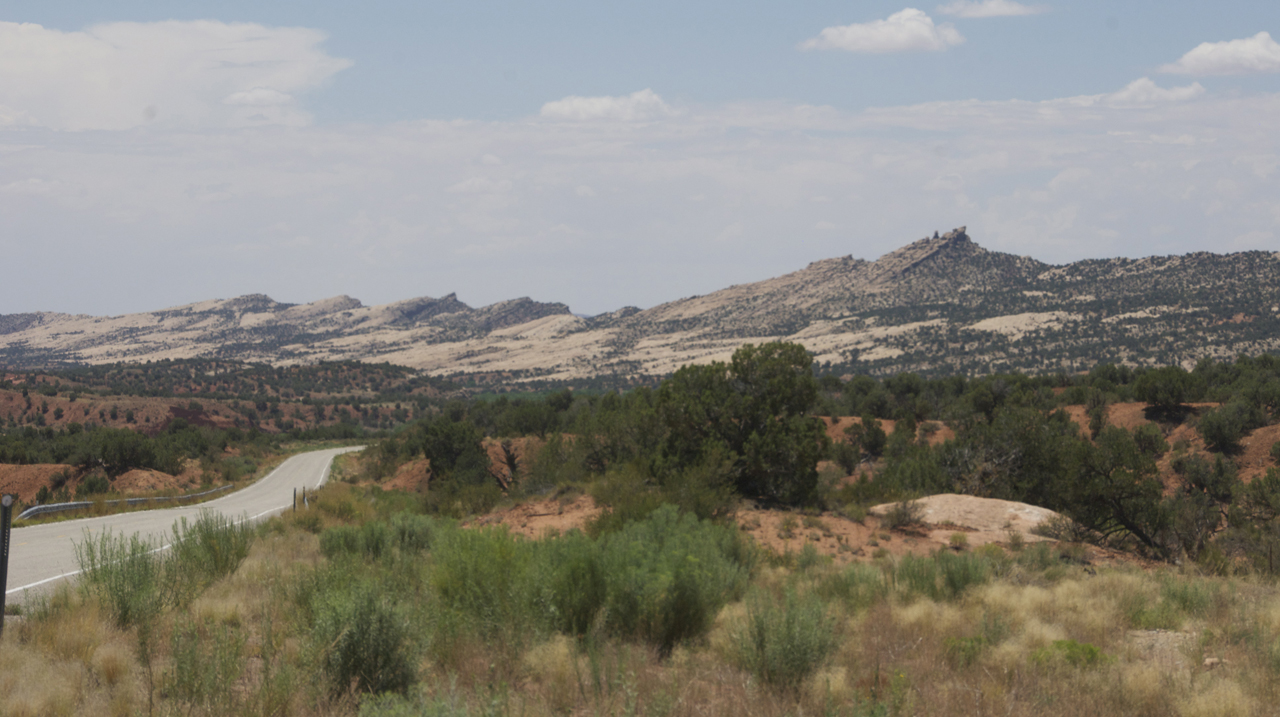
A short distance west from the turnoff on 95 the road rises toward Comb Ridge, which marks the eastern boundary of the Monument Uplift (at left, a detail from Barrs' map, showing the monocline dip at the eastern side).
In the image below you can sense where the "Comb"gets its name, since the tops of the Ridge look like a series of ("cock's comb") teeth points along a line. These are rocks of the Early Jurassic [200-175 Mya]. The white formation you see on the flanks of the hogback is exposed Navajo Sandstone (the vast windblown-sand-sea to be discussed in more detail further on), while topping the ridge is mostly the slightly earlier (deeper-lying) Kayenta Formation, though Navajo is at the top in some places. Click on the image to enlarge it.
The road here cuts through the ridge-top shown above and then runs along the edge of Comb Wash, where the image below was taken:
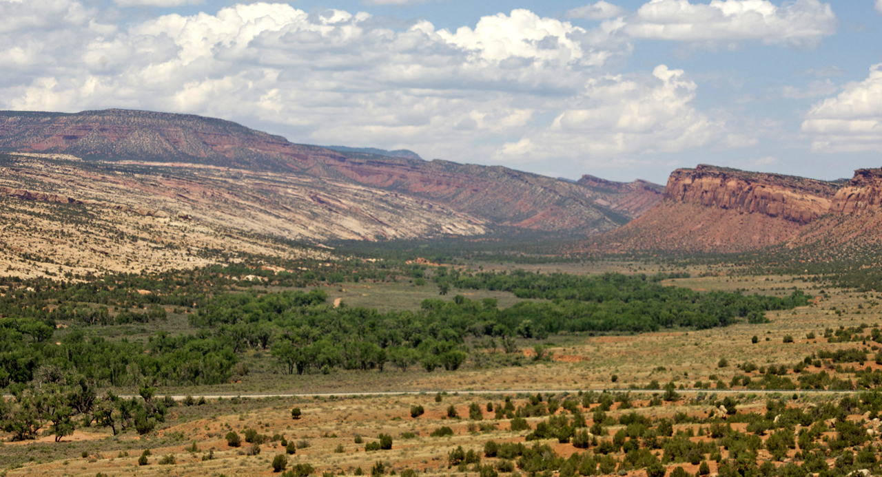
The road then swings westward across the wash as you can see, looking north. Here you see the Monument Upwarp Monocline exposed: the line of orange-to-reddish cliffs on the right are mainly Wingate Sandstone, an earlier windblown sand system of the Jurassic, not so extensive as the Navajo but interfingering with it (as we shall later see). Click on the image above to enlarge it. You can envisage this uplift rising much higher more than 40 million years ago, before millenia of erosion cut the layers out through what is now Comb Wash.
The Wingate Formation is well-rounded, fine-grained, quartzose sandstone and its iron-oxide cement helps to produce its characteristic pink-orange color. This sandstone was deposited in ancient coastal sand dune environments. The sand dunes covered most of the Colorado Plateau about 220 to 200 million years ago, straddling the Triassic and Jurassic boundaries at some 200 Mya. The three formations we have encountered here on the Comb Ridge -- Kayenta, Wingate, and Navajo -- are members of the (Jurassic) Glen Canyon Group, which we will see repeatedly later in the trip.
Below the Wingate (and now mostly buried under the more recent sediments of Comb Wash, which runs south into the San Juan River west of the town of Bluff, UT) lies the Late Triassic Chinle Formation, which we considered in detail in our March 2010 Petrified Forest Tour. We will see the Chinle again when we visit the Circle Cliffs Upwarp, prime generator of Capitol Reef itself.
Toward the left portion of the photo above, the erosion power of Comb Wash has exposed a major geological feature of the Monument Monocline: the Permian Cedar Mesa Sandstone, a dominantly white-to-yellow cross-bedded sandstone indicating 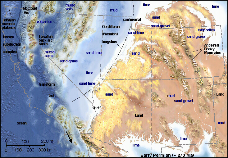 mainly aeolian origin, but also containing interbeds of red mudstone indicating occasional floods into the dunefield and discontinuous lenses of unfossiliferous gray limestone suggesting beach-and-sandbar conditions.
This formation, which is widespread in this area and up to 1,200 feet thick, is named after Cedar Mesa, which forms the broad expanse of the Monument Upwarp surface in this area, running southward all the way to the San Juan River (we will see this again later in the tour). Cedar Mesa Sandstone is the oldest member of the so-called "Cutler Group", Permian Formations of the Paleozoic Era which were laid down from 290-245 Mya. See Blakely et al for its suggested location and time period in the image at left. Click on the image to enlarge it.
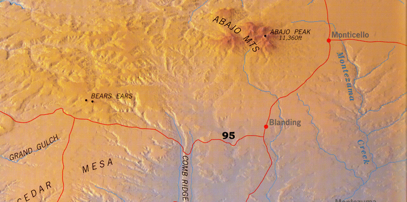
The road rises up on this Mesa as we travel westward on 95, now riding Monument Upwarp. We crossed the expanse of Cedar Mesa shown below (entirely missing sight of the "Bears Ears", very prominent paired buttes of Wingate Sandstone located north of the road, demonstrating its former coverage of the uplift), we eventually dropped into White Canyon, whose structural significance largely escaped me at the time though it was obviously a long and wide canyon and the views were beautiful enough. This road takes us off Cedar Mesa and the Monument Uplift and down into Henry Basin.
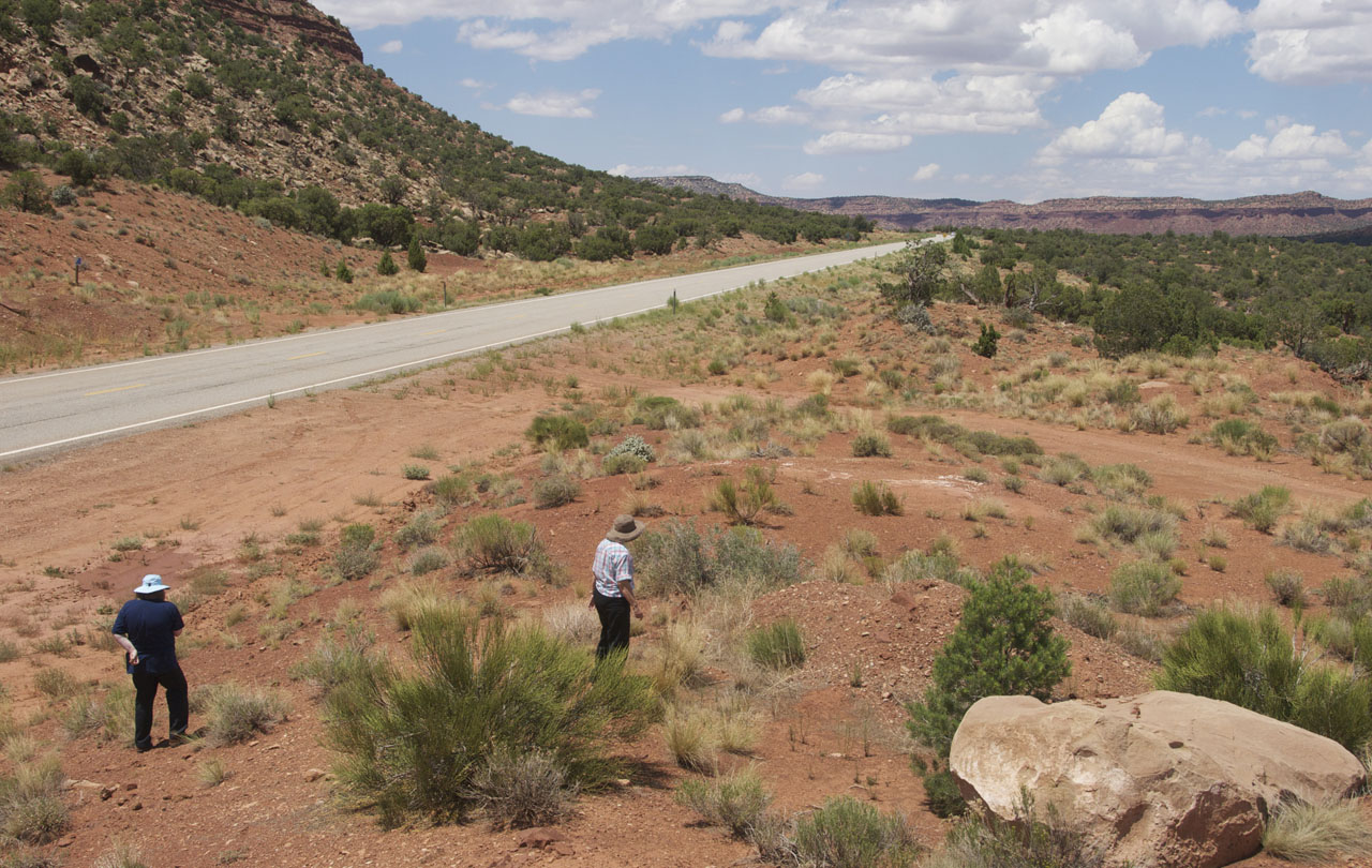
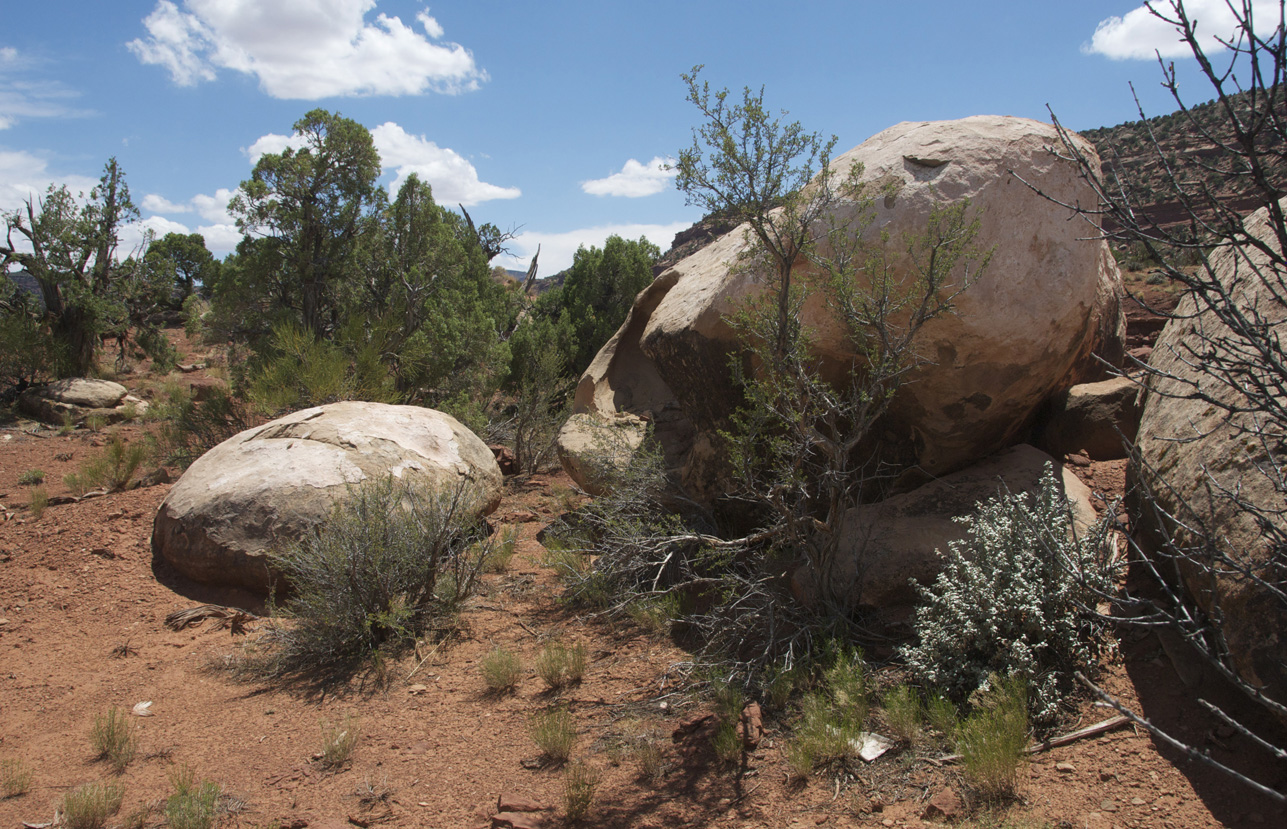
We did stop along the road once, below left, to check out local rocks, and below right to find a place to pee (and walk in beauty....) Click on each image to enlarge it.
 ..
..
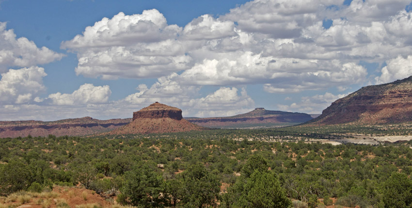
Below, for example, along the Canyon I photographed what is called "Cheesebox Butte", one of numerous picturesque structures visible along White Canyon. This is part of the Permian "Cutler Group" (ca. 300 Mya) -- the Organ Rock Shale, lumpy mudstones and sandstones formed in marine lowlands, braided streams and tidal flats, which is capped (and thus preserved) by the harder White Rim Formation (contemporary with the DeChelley Formation of Canyon de Chelley). Thus we had moved below the level of the Wingate and into the Permian. What I noted at the time, but neglected to register sufficiently, was the continuing presence along the Canyon floor of the Formation on which we had been driving, which was more of the Cedar Mesa Sandstone (just visible below at middle far-right), through which snaked what was clearly a rather meandering slot canyon. This is the popular White [Slot] Canyon of North Lake Powell (see this link), which includes the famous "Black Hole", one of "the premier canyoneering experiences in Utah". Our photographic work entirely failed to register this remarkable feature.
As 95 continues downslope on the Cedar Mesa Sandstone, it reaches the vicinity of the man-made Lake Powell, along the gently declining western flank of the Monument Upwarp. Here we will see again the well-named "Glen Canyon Group" members that we previously encountered at Comb Ridge, representing the other side of the upwarp, but having been eroded from it long ago.
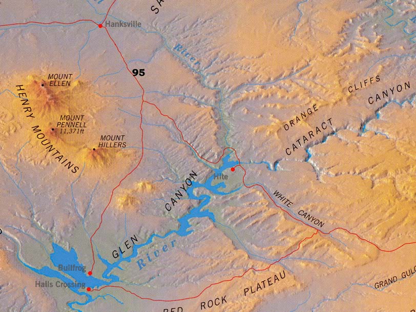
Below, near Hite and the bridge crossing of the Colorado River at this point, we see at left the Cedar Mesa Sandstone lining the banks of the lake, with the red Organ Rock Shale of later Permian above it. At right another perspective of the same, with a closer view of aeolian cross-bedding in this small portion of the Cedar Mesa Formation. Click on each image to enlarge it.
 ..
..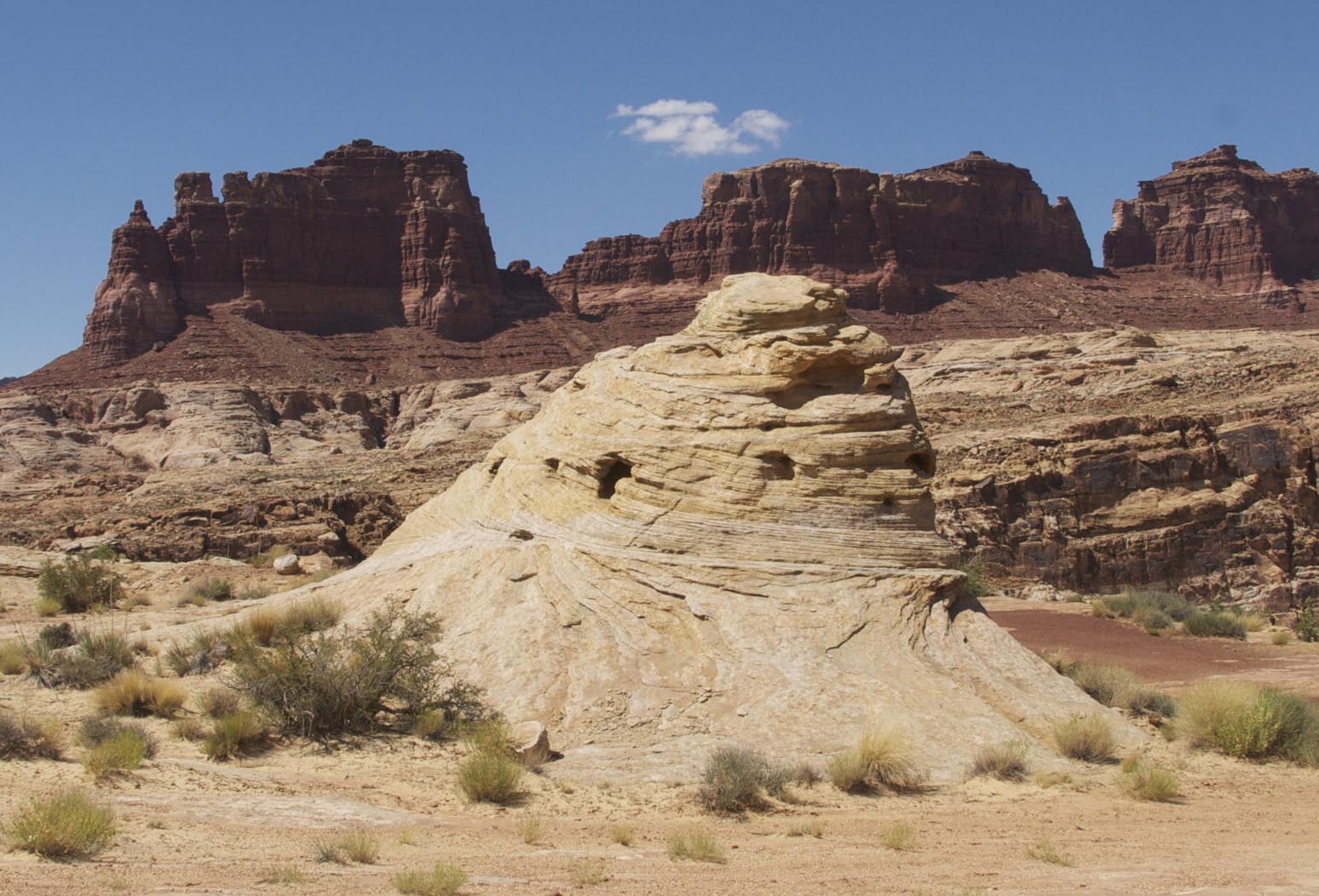
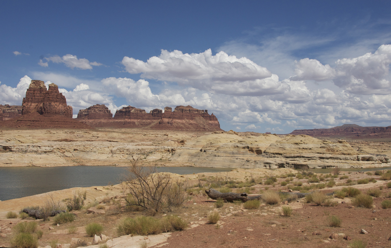
Finally, looking northwestward from a higher viewpoint, beyond the red rocks in the middle foreground we see below a massive, high sequence, with sloping siltstone and mudstone of the Moenkopi Formation and Chinle (Permian) formations, above which appear members of the Glen Canyon Group: vertical cliffs of the Wingate Formation and Kayenta Formation, topped by the massive, light-colored, rounded fins of Navajo Sandstone, a vertical series with the younger but very hard Formation at the top. We have reached the western end of the Monument Uplift, where the younger formations we last saw approaching Comb Ridge reappear as an escarpment.
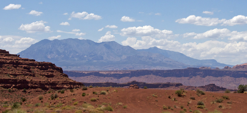
At far right, note the slopes of the Henry Mountains in the distance.
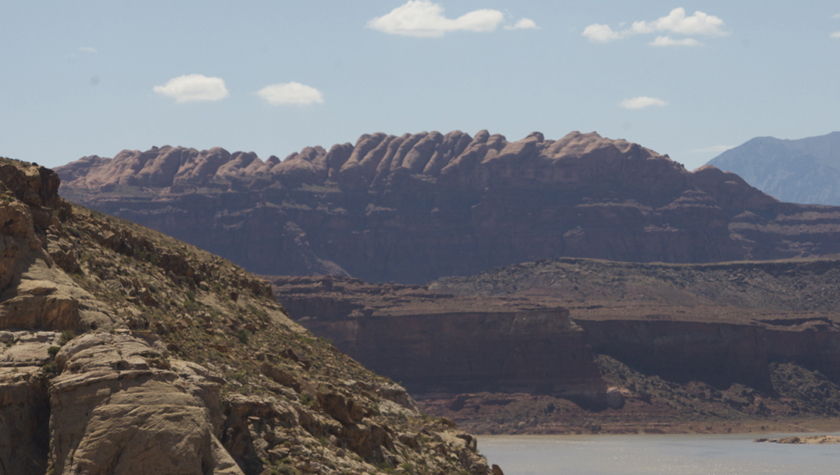
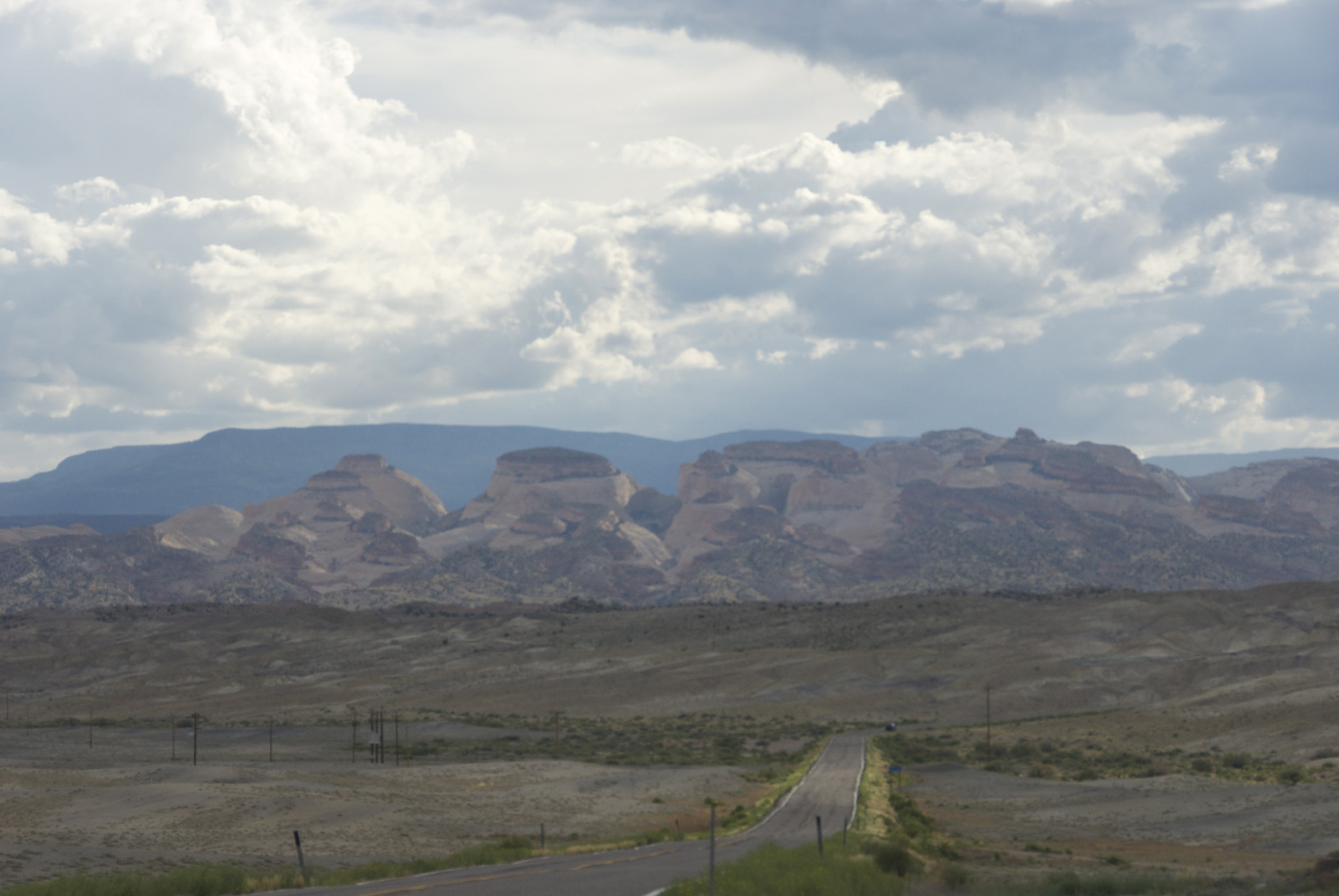
We took this image below of the Henry Mountains while still in the vicinity of Lake Powell. The northern group (on the right in the farther distance) rises to more than 11,500 feet in elevation.
Enroute to our intersection at Hanksville with the route to Capitol Reef, we pass east of these mountains, through what is structurally the Henry Basin. We took no photographs, but memorywise it did not look very basin-like to us, yet clearly it is a serious structural basin, as we will see below.
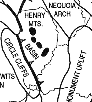
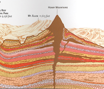
Below left, Barr's Map shows the Henry basin running from the western edge of the Monument Uplift to the edge of Capitol Reef (the here-unnamed mass extending at upper left). The (also unnamed) Colorado River runs down this map detail from upper right to lower left. Below right, this much-exaggerated geological cross-section of the Henry Mountains [adapted from Greer Chesher's Heart of the Desert Wind, 2000, pp. 33-4] illustrates a basis for calling this locale a basin despite how things largely look on the ground (as we shall see in much greater detail later). The underlying sedimentary structures of the area were formerly lower-lying, but the cluster of laccoliths (massive igneous intrusions) shown on map-left distorted them upwards, doming up the overlying Cretaceous structures. Since the intrusions have been dated to 44-21 Mya, they distorted overlying Cenozoic rocks as well. Subsequent erosion has exposed a massive mountain chain. The igneous rocks are gray, diorite porphyry, containing large crystals in a much finer groundmass.
 ..
..
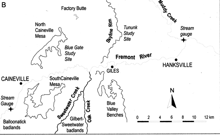
Actually, the basin structures to the west of the Henry laccoliths are much more pronounced than the Chesher diagram above implies. And on the eastern side, the recent pattern of erosion into the exposed formations there is busy contributing to the fill of an extensive basin system as well. The map below is adapted from a study by Godfrey etal, 2008, on the sediment delivery process in the Mancos shale "badlands" of this area. See this link: Sediment delivery.
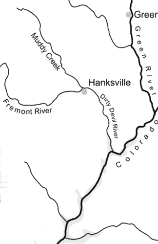
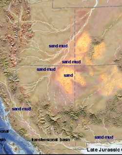
Note the names of the two rivers that drain through Hanksville: the Dirty Devil and Muddy Creek. Both imply a very murky runoff (and the Fremont River often has this feature as well). In the western part of this area the main geological formations are first the Mancos Shale members of the Upper Cretaceous, when, approximately 94 to 85 million years ago, the seaway advanced onto and retreated from land laying down the Mancos Members, composed mostly of shale but two of its members, the Ferron and Muley Canyon, are sandstone that were laid down when relative sea level temporarily dropped. (See Cretaceous Paleogeography for map context.) So as we travel northward and westward along this basin, we encounter remains of more recent formations than we have seen since Blanding.
Second, large outcrops of the Morrison Formation are also present here from Hanksville to Notom (the latter is not shown in this map) and down the Waterpocket Fold (as we shall later see). This formation dates from the late Jurassic (155-148 Mya) deposited as alluvial plain, floodplains, river channels, and in hyper-saline lagoons, Some show varicolored mudstone with interbedded sandstone, limestone, and gypsum. The youngest, Brushy Basin Member involved lakes and wetlands. See Jurassic Paleography, Last Map.
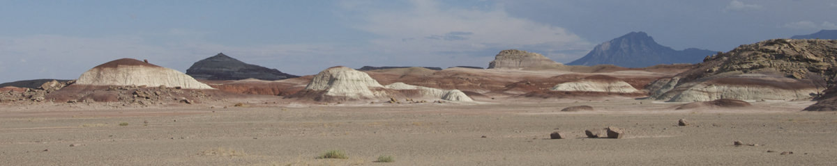
Godfrey et al. worked at a series of sites associated with the Mancos Shale, as shown in the map below. The areas near the Caineville Mesas provide remarkable views of this formation.
We however were distracted in our arrival at Hanksville, seen below thanks to Google Earth: Click on the image to enlarge it.
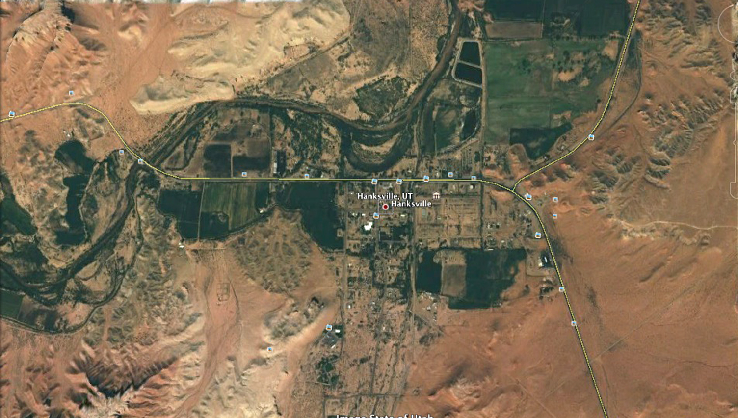
You can see that the Fremont River swings northward here, flowing toward its confluence with Muddy Creek. With our intent to reach Torrey before dark, we did not linger at Hanksville, but were briefly drawn aside by a report in William Kappelle's Rockhounding Utah (2008), which directed us to a dirt road just west of town where, he reported, agates were to be found in the "Badlands" [pp. 146-7]. So we entered this little road, which took us into the swirling countryside you see north of Highway 24 (again, in this Google Earth view below):
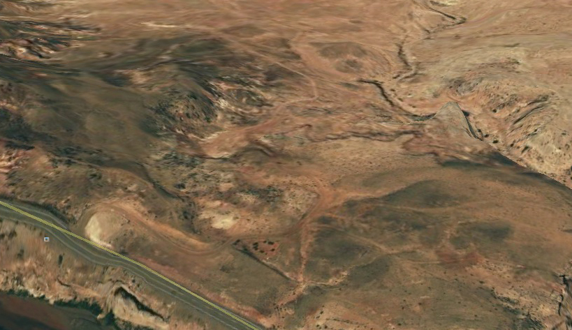
Thus we entered what seemed to me an eerily familiar world, reminding me of the Chinle Formation we saw so much of during our July 2010 Painted Desert tour, though the two formations formed more than 50 million years apart. Click on each image below to enlarge it.
 ..
..
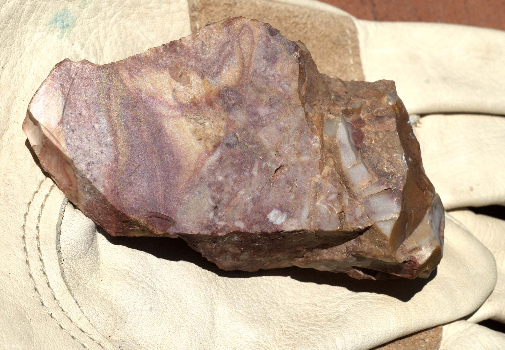
We did find some agates (the one at left -- click on it to enlarge -- was the largest and most striking; the sheer-flat face of the surface is completely natural). This experience has led me to a website on the subject: The Gitche Gummee Museum, which gives what looks to me like valuable information on their geology and varieties.
But then we departed this scene in some haste, partly worrying about imminent rainfall prospects (bentonite-laden soils are ill-suited to muddy driving) and partly concerned for our time of arrival at Torrey, where we had a motel reserved.
You may imagine my later surprise to learn that the area we were so briefly touching contains two features of considerable interest:
(1) In the immediate area is the Mars Desert Research Station (see that link for an example of recent study of local concretions analogous to those found on the Red Planet), and
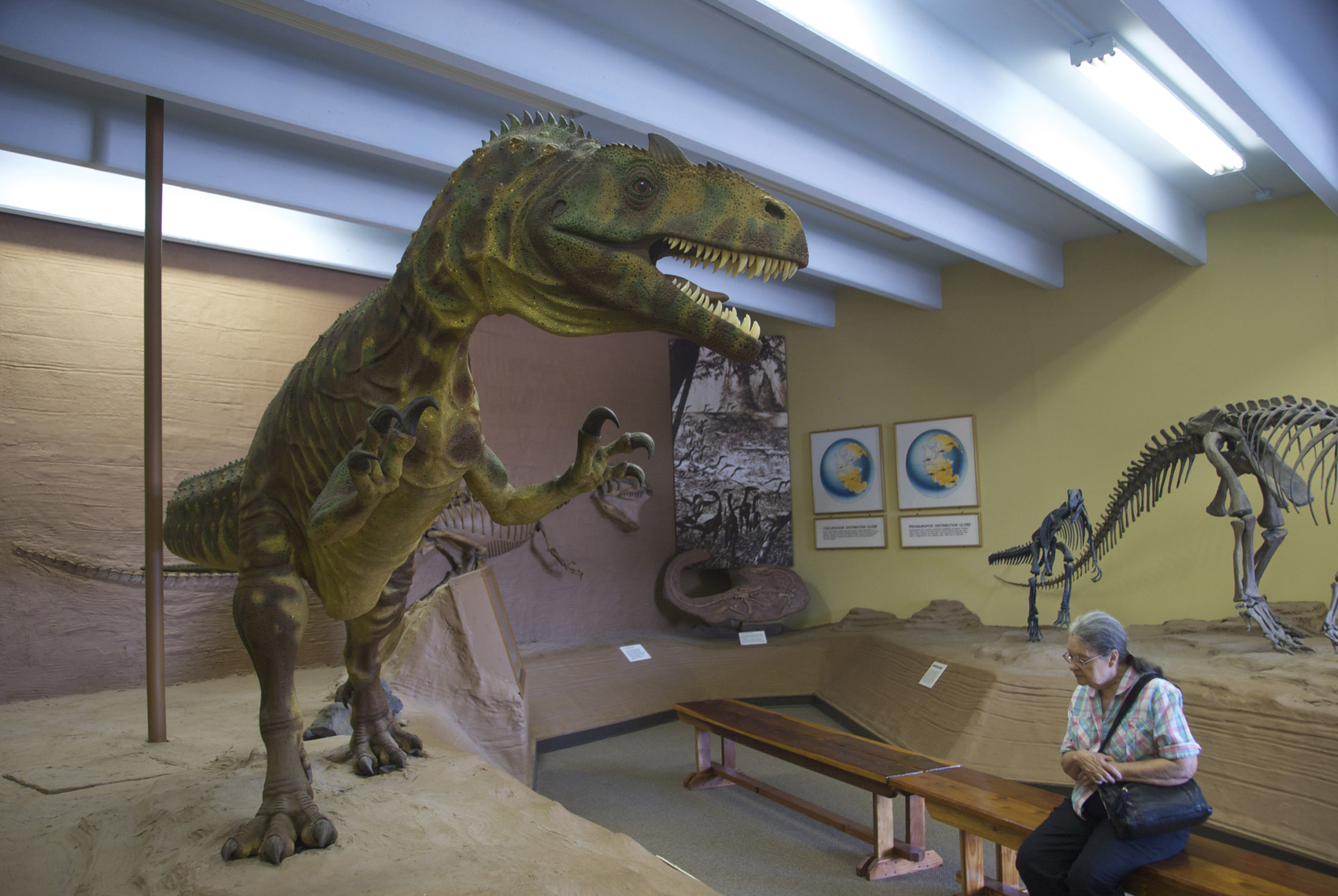
(2) the same locale boasts what is now called the Hanksville-Burpee Quarry, a place long known to local rock-hounds but which scientists from Burpee Museum of Natural History and Western Illinois University have recently found "a probable Stegosaurus, four sauropods, and at least two carnivorous dinosaurs" in sediments situated at the bend of a large river during Morrison Formation times (Brushy Basin Member (150-145 Mya) and where "the large number of animal remains collected at the single location... suggest the river bend acted as a trap for carcasses of large animals that died upriver and were carried downstream by high waters." Allosauarus fossils are a part of this mix, but Helen seemed unimpressed with the one she encountered below at Blanding: Click on the image to enlarge it.
[I insert here: After our return from the trip, and my belated consulting of the USGS Geological Map of the Salina Quadrangle (1971), I could see that Late Jurassic Morrison Formation rocks (including light-red, purple, and grayish-green bentonitic lacustrine mudestone) are exposed north through south on the west side of Hanksville and flanked further to the west by a parallel line of the Lower Cretaceous Cedar Mountain Formation (of similar appearance). Both of these formations have gained great renown for producing fossils. The Morrison is flanked here on the east by the Upper Jurassic Summerville and Curtis Formations (which actually run through the center of Hanksville town itself, but Morrison lies a short ways away directly to the north).

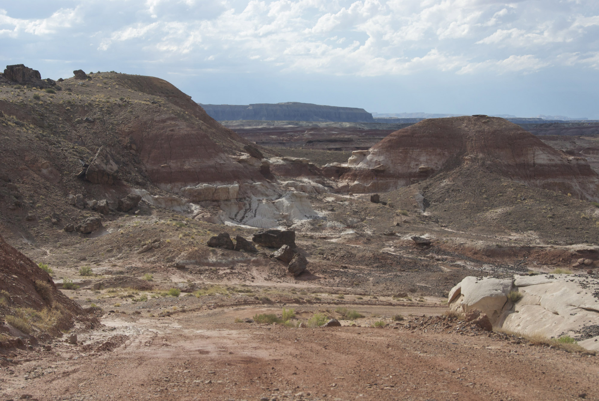
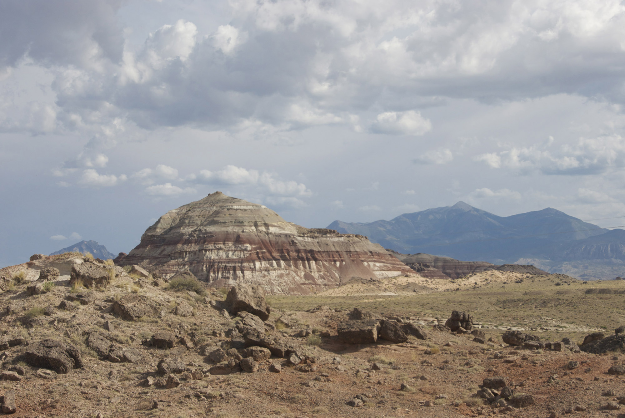
For example, look at this remarkable array of what I presume is late Morrison (but might instead be Cedar Mountain) Formation, located a short distance west of Hanksville on the north side of Route 24. Regardless of which particular Formation it is, this is a Badlands to reckon with for anyone intested in geology or just landscape weirdness.. (Click on the image to enlarge it.)
This would be an astonishing array of badlands to wander through, searching to find "members" of the distant past (including versions of oneself).
We will see more of this area, specifically of the Muddy Creek to the north and northwest, in the next part of this story.
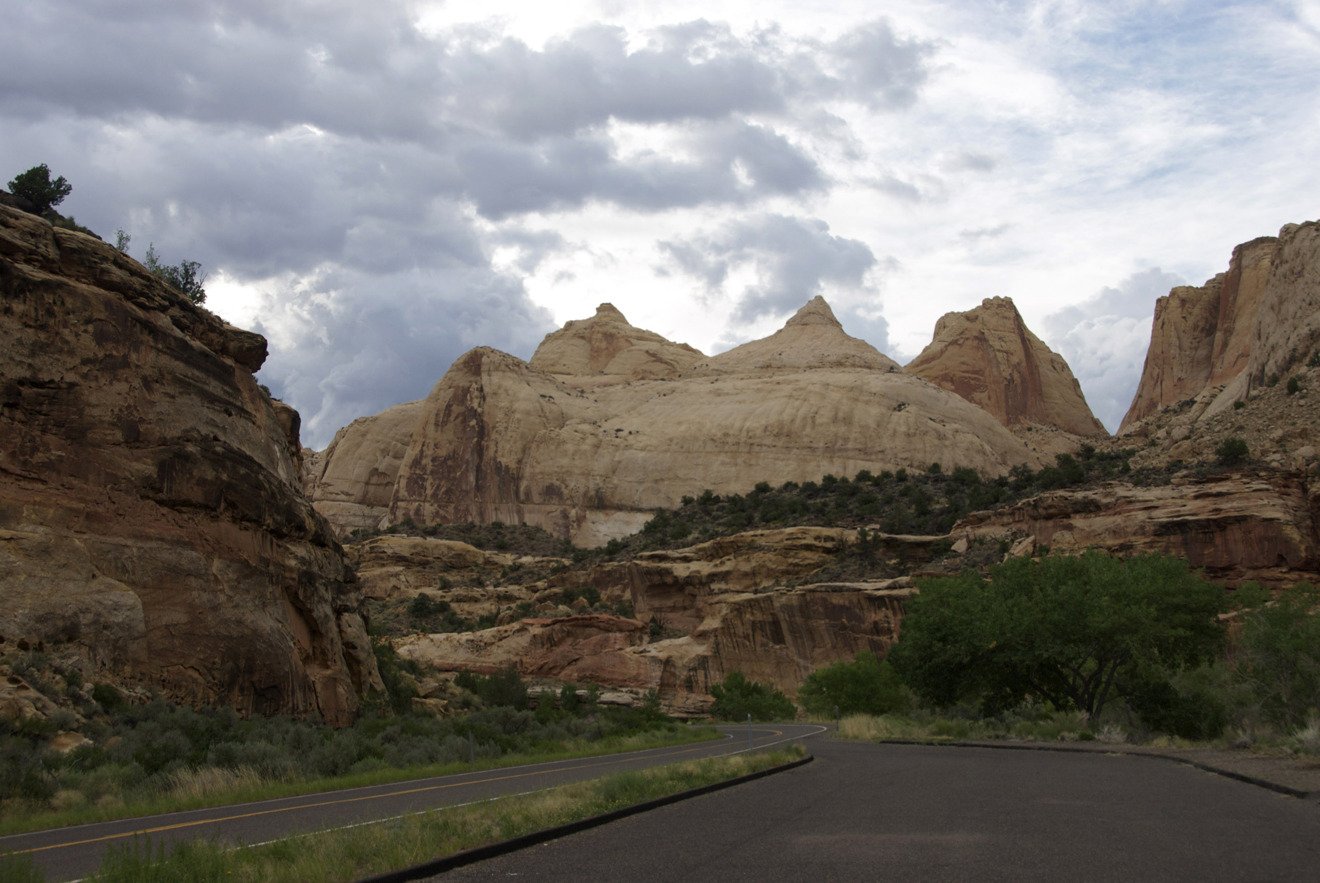
At the time of our own brief deposition in the vicinity of Hanksville, we knew nothing of these remarkable facts, and (driving up the Fremont River Canyon through deepening evening) were mainly pleased at last to see our next destination, the end of the Henry Basin and the rising of the Capitol Reef, with the massive eastern end of the Aquarius PLateau, the Boulder Mountains looming behind it, topping out at some 11,300 feet in altitude. Click on the image to enlarge it.
And finally, in near-twilight below, the iconic structure of Capitol Dome itself, a miniscule portion of that Navajo Formation sand-sea which refuses to disappear after 200 million years (and whose shape here might as well have been named "The Tetons"). Click on the image to enlarge it. Much more on the subject of the Navajo Formation will appear in Part 3.
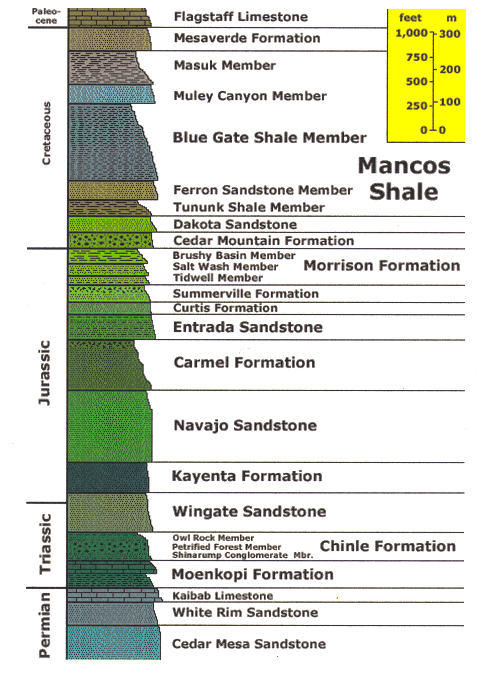
At left: Capitol Reef Geological Strata Series
Click on the image at left to enlarge it!
To Part Three: Capitol Reef & Vicinity; Boulder Mountain, Burr Trail, Circle Cliffs, Waterpocket Fold
To Return to Part One: Introduction