The High Tank
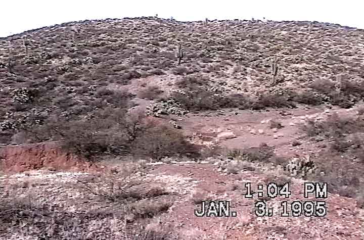
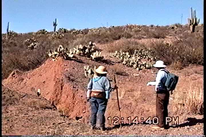
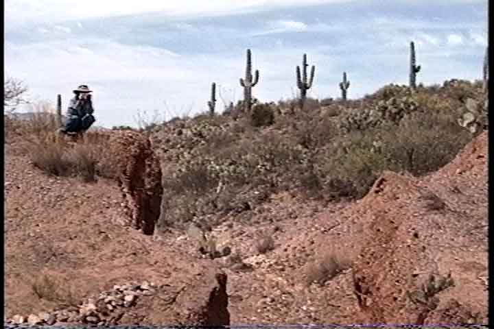
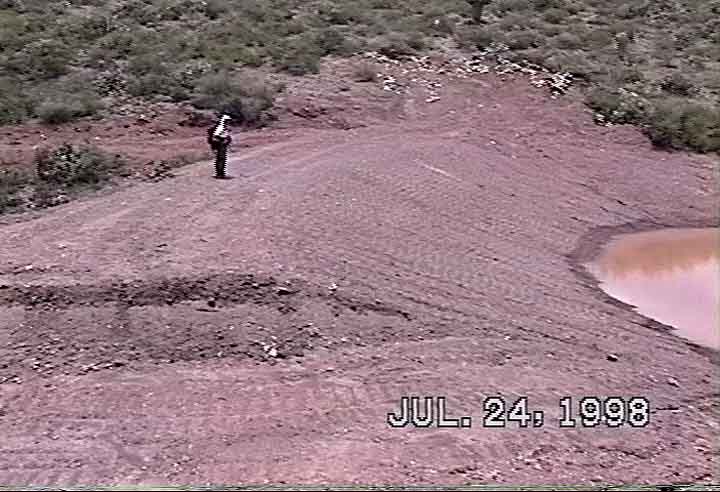
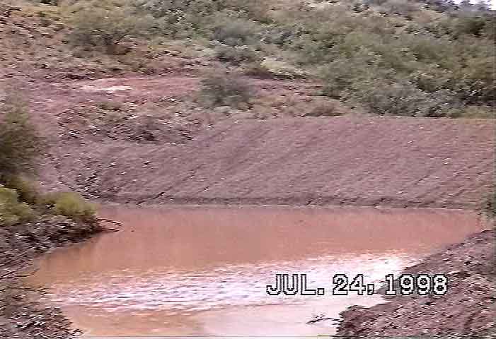
We initially called the High Tank the "Broken Dam", because some years before S-J acquired our grazing lease in 1988 it had blown out (perhaps in the major flood of 1983?). Below left, a view of the old tank from the hill above it to the east. The red gash at far lower-left is part of the sharply-eroded spillway. The wash runs from upper right of the photo into the old tank basin, where -- in the center of the photo -- you can make out where the breach has formed a cut in the middle of the tank fill. In the center photo, Nancy Ferguson and Tom Orum view the gash running through the tank's face, and at right you see the gash from directly upstream. The tank had clearly survived for many years, since it contained a substantial residual fill.
 ..
.. ..
..
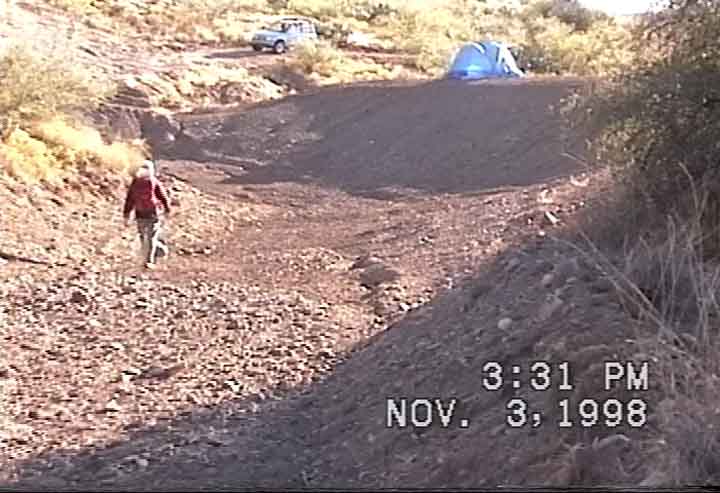
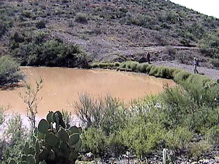
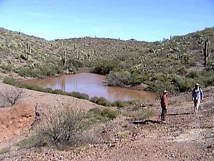
In 1998, we rebuilt the High Tank as part of a USDA EQIP project (see "Policies and Contexts" in our page on "Grazing and Land Restoration"), and by November it had already caught water. Below left, you can get a sense of how much more substantial the new tank is than was the old one. The spillway appears at the bottom of the photo (its middle lies where the date information is). In the middle photo, you can see the position of the spillway at the left -- the "Achilles Heel" of this structure, being made of dirt. Below right, by November the tank had drained, as can be seen in this view from upstream. (Click on each image to enlarge it.)
 ..
.. ..
..
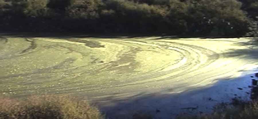
Then came the heavy rainfalls of October 2000 (the Elliott Weatherstation several miles to the west received almost 6 inches during that month, nearly as much as it received in October of 1983, the Big Flood year), with runoff which abruptly filled the tank to overflowing. Below left, a view from the upstream side; below right, from the downstream side.
 ..
..
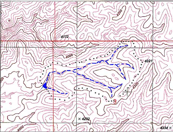
We then realized that this tank combined a limited storage capacity -- and a dirt-fill spillway -- with a comparatively large watershed, a problem which probably caused the 1983 blow-out after those very heavy rains. The map below shows the main washes feeding the High Tank in blue, with the gray dots outlining the rough size of the watershed. Hill 4321, located at the far northeastern edge of our lands, is the highest point on them except for Sierra Blanca. (Click on the image to enlarge it.)
Observing that the new spillway was already beginning to erode from this overflow, we recognized that immediate steps to strengthen it were imperative, and so at the end of October we built a series of spillway gabions along the spillway to slow any future runoff.
For details of this work, see: The High Tank Gabions Project