Dragoon Mountains
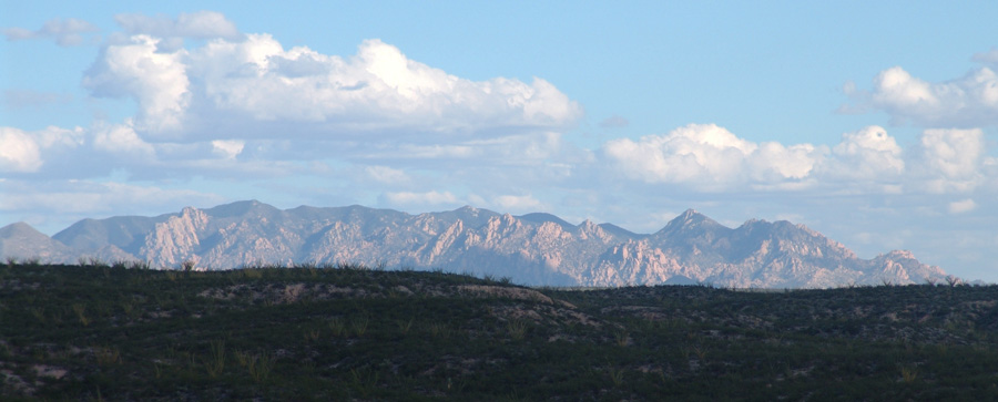
Above, a view of the northwestern side of the Dragoons taken from the high terrace above Tres Alamos Wash of the Middle San Pedro Watershed, August 20, 2007. This nicely suggests the ruggedness and diversity of this Sky Island, with pine forests in dark shadows above and behind the sunlit, jagged facing cliffsides that frame the northwestern front.
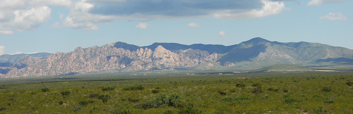
Below, the western face of the Dragoons are seen from the lower reaches of Middlemarch Road off State Highway 80, just north of Tombstone, on September 2, 2008. From foreground to middle distance you see a very rich example of Chihuahuan Desert, with densely packed vegetation running up the entire bajada slope. Click on the image to enlarge it.
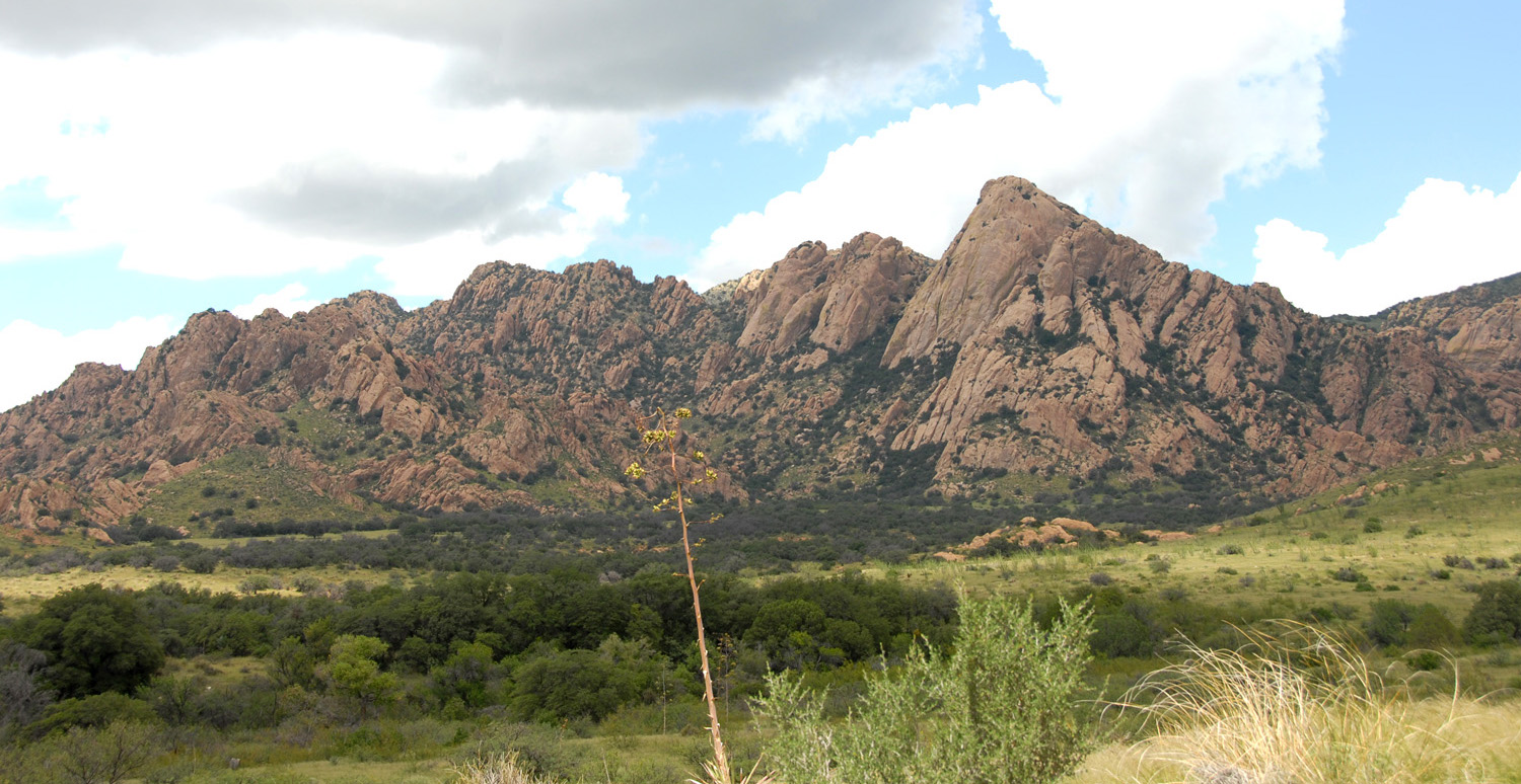
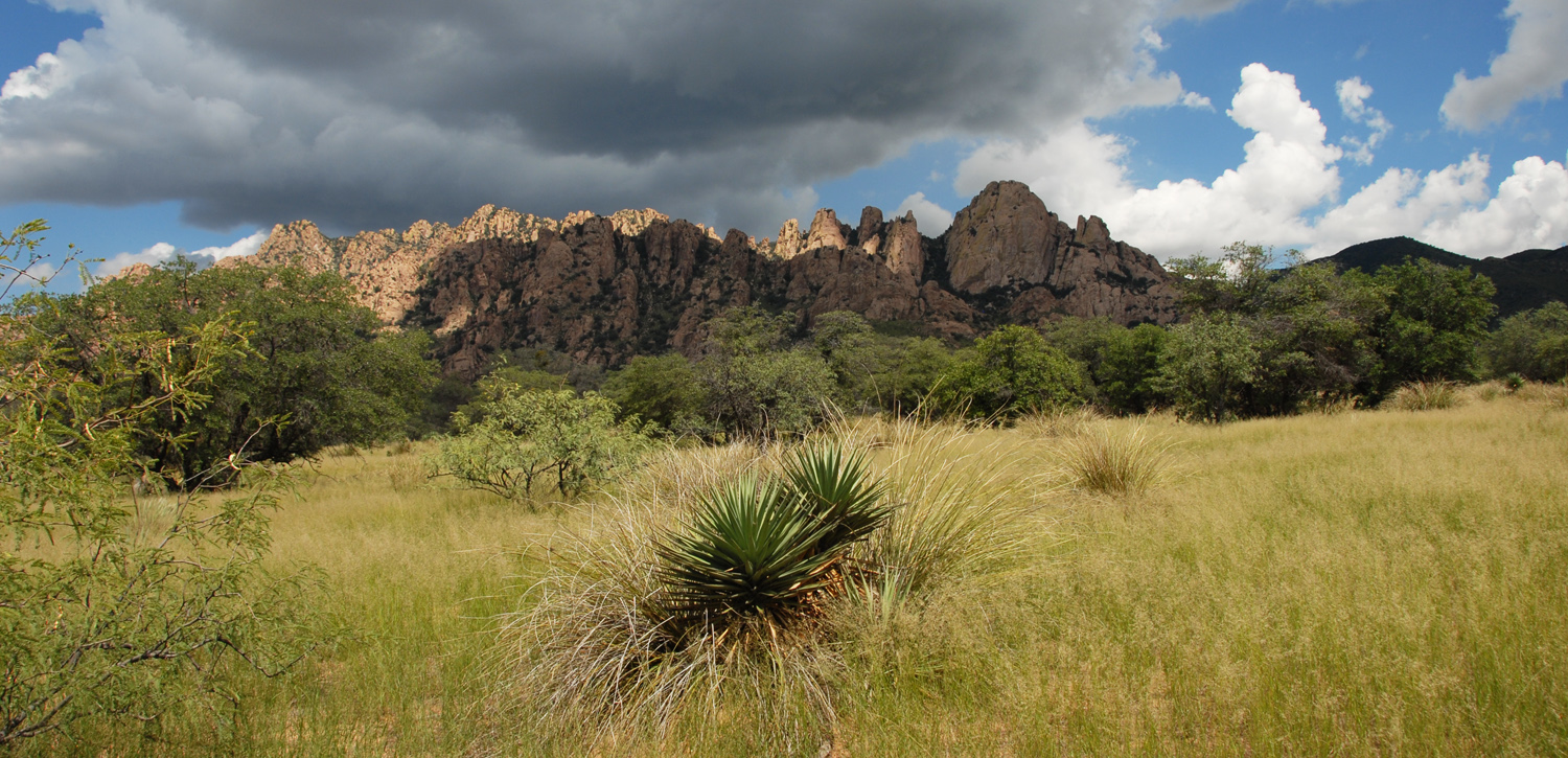
Below left, the north side of the western face of the mountains viewed from near the pediment, at an elevation around 5,000 feet above sea level; below right, the south side of the western face from the same pedimentary stance. As you can see, the northern half of these mountains are volcanic in origin, the southern half, much older sedimentary rocks in a tilted stance. See more further below.
 ..
..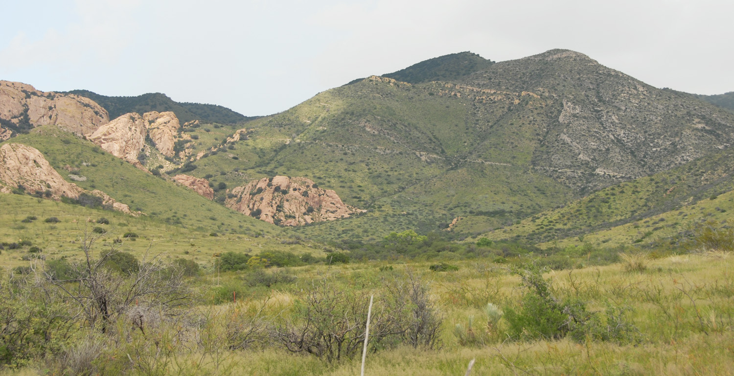
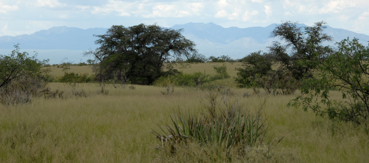
Descending from the pediment of these magnificent mountains runs a broad stretch of rich Apache Highlands Grasslands, which extends from the top of the pediment below left well downslope (below right), gradually merging with the Chihuahuan Desert flora discussed above. In the image at right, you can see the massive Sky-Island of the Huachuca Mountains stretching across the horizon on the western side of the San Pedro River Valley. Click on each image to enlarge it.
 ..
..
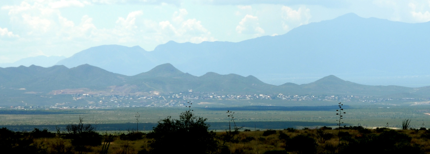
Below, a view across the San Pedro River Valley to the Huachuca Mountains, vague blue backdrops at the upper right horizon, showing the Apache Highlands Grasslands in the foreground, the Chihuahuan Desert bajada stretching far out toward the valley, and in the middle distance, nestled on the eastern slopes of the Tombstone Hills, which reach about 5,000 feet in elevation, comparable to the pediment on which the photographer stands, lies the town of Tombstone, about left-center in the image. The San Pedro River lies beyond these hills, but the Dragoons bajada extends unbroken all the way to the river at Fairbank (beyond the image, off to the right) at an elevation of less than 3,800 feet. While Tombstone appears here as a small cluster of dwellings, Interstate Highway 80, which runs up-and-down-valley through Tombstone on its way to Douglas, Arizona and beyond, while mostly only two-lane through its entire stretch and mostly posted at 50 MPH, carries numerous heavy, many substantially large vehicles most of which drive at 60 MPH or higher. As such, it comprises a significant ecological barrier to the migration of terrestrial vertebrate wildlife between the two Sky Islands. Click on the image to see Tombstone a bit better.
Below, a map of the Dragoon Mountains beginning on the north side. At top left, an outlier of the Little Dragoons abuts on the red line marking Interstate Highway 10 where it runs through Texas Canyon. This highway, and also of course the nearby railway line that roughly parallels it here, comprise major ecological barriers to the migration of terrestrial vertebrate wildlife between the Sky Islands of this area.
Cochise Stronghold, marking the historic camp of a major Apache chief during the 1860s, is visible at map central. See the Cochise Stronghold Bird List for some hints of the richly diverse wildlife inhabiting these mountains.

Below, a map of the southern portion of these mountains, ending at Dead Mexican Canyon at the southeast.
